Lewes to host FirstMap presentation June 27

The Lewes Mitigation Planning Team is set to host a presentation on FirstMap at 7 p.m., Tuesday, June 27, at the Lewes Public Library.
FirstMap is the State of Delaware centralized repository for commonly used geospatial data layers. The service includes a convenient, online portal for self-service data discovery and mapping. Several of the online maps and many datasets are extremely useful for those looking for information on topics such as hazard mitigation, climate change or promoting community resiliency.
State representatives who host and help maintain FirstMap from the State of Delaware Department of Technology and Information, the Delaware Office of State Planning Coordination and the Department of Natural Resources and Environmental Control Coastal Programs will be on hand to demonstrate the technology and discuss ways to use it to gather information or support planning initiatives.
The event is open to the public. Attendees will be able to see FirstMap in operation and obtain information on how they can access the online system on their own using any internet-connected device. They are also welcome to bring a Wi-Fi-enabled laptop or tablet to connect to FirstMap. In addition to learning about FirstMap, the Lewes Mitigation Planning Team will share information about its ongoing and future activities, and discuss questions or concerns raised by attendees.
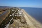
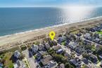
As a coastal community, Lewes and its residents are keenly interested in issues such as preparing for storm events, monitoring sea level rise and improving resiliency. This event will be a great opportunity to learn about this valuable new tool that helps increase awareness of conditions that can create difficulties as well as opportunities to better safeguard the community with proper planning.