Tropical storm may brew in Atlantic this week
AccuWeather reports a tropical wave west of the Cape Verde Islands looks like it could be the next named tropical storm in the Atlantic Basin.
The wave came off the coast of Africa this weekend and survived the cooler waters and dry air, and has been rapidly organizing ever since.
The storm is leaving cooler waters, reaching towards an area with water temperatures in the lower 80s, which are ideal. The area to the storms west also appears to have light wind shear, making it even less likely that the storm will be ripped apart by winds higher up in the atmosphere.
"If this process continues this feature could become an organized tropical system within the next 36-48 hours," warnedAccuWeather.com Tropical Expert Dan Kottlowski.
However, there is one major factor that could inhibit the strengthening process. Both sides of the tropical wave are surrounded by dry, Saharan dust that could pull away at the storm's moisture.
This means the system's full development could be slowed slightly as it steers towards the northern Leeward Islands.
"Models are strongly suggesting that we will have a fully developed tropical cyclone by the latter part of this week," Kottlowski said.
If this system does continue to develop, it would be the second named storm in the Atlantic this season. The next name on the list is Bertha.
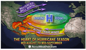
The relatively quiet Atlantic tropical season so far in 2014 is not that uncommon. Although the season officially begins on June 1, the most active period does not really get going until mid-August.
At this time is when the waters across the Atlantic are the warmest, and typically, the dry air and strong wind shear tapers off.
For more information go to www.accuweather.com/en/weather-news/tropical-storm-may-brew-in-atl/31213830.


