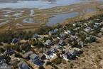
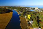
Lewes Beach residents sound off on proposed ordinances

Lewes Beach residents used their opportunity to speak at a May 3 public hearing to discourage mayor and city council from passing two controversial ordinances aimed at addressing sea-level rise and source water protection.
The ordinances could be considered for a vote by council as early as Monday, May 17; however, Mayor Ted Becker hedged by saying the May 8 election could affect council’s readiness to move forward.
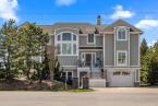
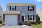
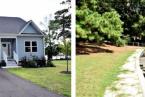
While many residents agreed with the spirit of the ordinances, they said the new regulations would hinder their property rights and significantly impact property values on Lewes Beach.
The Sussex County Association of Realtors joined with residents in opposition, submitting a letter opposing both proposed ordinances on the basis that they infringe on property rights for about 1,200 property owners.
“These proposed changes pose a significant threat to property values and create the concern that a property owner, along with their Realtor, will be hindered in their ability to accurately market and sell their properties with appropriate disclosures,” SCAOR President Chrissy Steele wrote.
Source water protection
The proposed source water protection ordinance would allow up to 50 percent impervious cover on individual lots within the excellent recharge area overlay. It would also require all driveways, sidewalks, patios and decks to be made of permeable pavement or materials.
Luke Mette, representing the Lewes Beach Civic Association, said the city’s justification for the ordinance has changed. After it was determined water in the excellent recharge area does not flow back into the aquifer from which the city pulls its drinking water, he said, city officials determined the ordinance was needed to stave off saltwater from intruding inland toward the wells.
“The city appears to have reached its own, preordained conclusion to limit development on Lewes Beach, using changing justifications that have not been subjected to rigorous public and scientific review,” Mette said. “The manner in which the city has approached the proposed ordinances has had an immediate, negative impact on the Lewes Beach community.”
He asked that the city take a pause and work with the community to develop rational solutions.
The source water protection ordinance would apply to all properties, no matter their zoning. For a general commercial lot, like one owned by Rick Quill, the maximum lot coverage would fall from 95 percent to 50 percent.
“It’s a severe impact on our property,” Quill said. “I’m not willing to give up one inch of my ground.”
He said there are thousands of acres of open space within the excellent recharge area that will never be developed. He also pointed to a city-commissioned report from consultant Environmental Resources Management that encouraged the city to incentivize commercial development along the Savannah Road corridor, and said the proposed ordinance would do the opposite.
Tonya Flickinger agreed with Quill’s observation about permanent open space within the excellent recharge area. She asked if anyone has determined how much land is currently covered with impervious surfaces. She brought up the city’s March 29 meeting when experts Scott Andres of Delaware Geological Society and Steve Smailer of DNREC’s Department of Water Resources said 20 percent impervious cover is a threshold for when negative environmental impacts begin. Flickinger argued the 20 percent number should be cumulative of the entire excellent recharge area instead of each individual lot. If the area as a whole is under 20 percent, she asked why the city is moving ahead with the ordinance.
“If that’s the case, I would really love to know why a more restrictive impervious coverage [rule] is needed given that the experts on March 29 said you don’t see problems until impervious surfaces get over 20 percent,” she said.
She also warned mayor and city council that legal action could be coming.
“Is the city prepared financially to absorb the almost certain litigation that it will face from homeowners who believe their property has been erroneously devalued by this ordinance?” she asked.
David Sheehan said there are few to no stormwater management systems in place on Lewes Beach. Since the city is not extracting drinking water from Lewes Beach, he said it doesn’t make sense to impose new regulations that will only impact about half of the properties between Savannah Road and Roosevelt Inlet.
“Every drop of rain that falls on Lewes Beach is absorbed by Lewes Beach,” he said. “This whole conversation is nonsensical to me. It’s just absurd.”
Cole Flickinger agreed the lack of stormwater management facilities on Lewes Beach should be a factor.
“When the rain falls by our house, it hits the hard asphalt and runs off the road and infiltrates in the sand in our yard,” he said. “We feel it’s unfair to ask the homeowners to manage their own stormwater on site while the homeowners are also managing the stormwater runoff from the adjacent streets.”
Pervious pavement was used when Bay Avenue was repaved in 2012, but the other streets of Lewes Beach remain impervious. At its April meeting, the city’s planning commission recommended mayor and city council use permeable pavement in the future whenever possible.
As a result of the ongoing discussion about the source water protection ordinance, many residents have had building permits on hold. Mayor and city council at its Feb. 8 meeting decided, without a vote, to end the city’s practice of non-enforcement of the source water protection ordinance already on the books. That ordinance allows property owners up to 20 percent lot coverage, with the option to increase coverage to 50 percent with an environmental impact analysis that shows runoff conditions will not increase under the new footprint.
Any application that exceeds 20 percent lot coverage without the environmental report cannot move forward until mayor and city council determines what it wants to do.
Quill, who also lives on Lewes Beach, called for all permits on hold to move forward. He also chastised city officials for pushing a narrative that Lewes Beach properties are at a high risk for flooding and storm-related damage.
“To paint this part of town as if it’s in imminent danger devalues the property and sends the brand out there that these people have to be nuts to buy over there,” he said.
Sea-level rise ordinance
The proposed sea-level rise ordinance would apply to all properties located within the 100- and 500-year flood plains. Like the source water protection ordinance, the sea-level rise ordinance would limit the amount of impervious surface allowed on a lot.
The ordinance allows 50 percent maximum coverage with the option to increase to 60 percent with implementation of three runoff reduction practices.
All residential property on Lewes Beach, except for a few marine-commercial parcels, is zoned R-3, which currently allows 65 percent lot coverage without any additional requirements. Based on the 500-year flood map, some R-2, low-density residential, and R-5, mixed residential, properties would be subject to the ordinance. R-5 properties already have lot coverage equal to the sea-level rise ordinance, while R-2 currently allows up to 65 percent lot coverage. Some commercially zoned property, which allows up to 95 percent lot coverage, appears to be close to the 500-year flood plain.
The current draft of the ordinance applies to construction of critical facilities and redevelopment of residential property. New residential development will be addressed at a later time. A project is considered redevelopment if it meets the definition of substantial improvement or substantial damage.
The ordinance creates a formula to determine the required height for the first occupied floor. Currently, a home within the flood plain must be raised to the height of the base flood elevation, then an additional 18 inches, known as freeboard. If the proposed ordinance is adopted, a home must also be raised to meet sea-level rise projections 50 years in the future, based on the most recent data available.
Current models project sea-level rise of about 23 inches by 2071. Under the proposed formula, a home would be raised to the base flood elevation, plus 18 inches for freeboard, then an additional 23 inches for sea-level rise.
Tonya Flickinger argued that the increase is too great, and that the city should instead use the 50-year projection minus the 18 inches because freeboard is already designed as a buffer in case the Federal Emergency Management Agency’s determination for base flood elevation is slightly wrong.
Several residents also pushed for the city to increase the maximum building height if they are required to lift their homes higher off the ground. The proposed ordinance does not allow for increased building height.
The critical facilities portion requires use of the 40-year sea-level rise projection. It encourages new construction of critical facilities outside the flood plain; however, if such building or redevelopment occurs, the proposed ordinance expects the facilities to be built to the 80-year sea-level rise projection.
Examples of critical facilities include city hall, the New Road bridge and pump stations.
Some residents were under the impression that the wastewater treatment plant on American Legion Road next to the marsh and Lewes-Rehoboth Canal is exempt from the regulations, but Planning and Development Officer Janelle Cornwell said that is not the case.
“The wastewater treatment facility would be required to comply with the ordinance,” she said in an email May 4.
The city will accept written comments on the proposed ordinances until the close of business Friday, May 14.