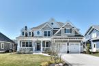
Thanks for the informative article on the progress of the townhouse development along New Road called the Lewes Waterfront Preserve.
Several things about this article did not seem to represent the reality of the situation that exists along Canary Creek and New Road as presented by the developer.
Although this tract of land is mostly not in the flood plain as represented by the FEMA flood maps, and the developer claims to not be erecting townhouses within the flood plain, a good portion of this tract of land was covered by water during the 1993 nor’easter named “the perfect storm.” This storm pushed and held water into the Delaware Bay, which flooded most of the surrounding wetlands and buffer zones.
This type of high-density development near the flood plain tends to void the flood insurance discounts given to area residents by FEMA. This discount is given in areas where there is active flood plain mitigation limiting the density of development in and around the flood plain. To the best of my knowledge, Lewes has no flood plain mitigation manager currently. So, attention area residents, your flood insurance rates will continue to go up as long as this type of high-density development occurs near the flood plain.
So what is the Lewes Waterfront Preserve actually preserving? Higher flood insurance rates? Intolerable traffic and population density? If the developer actually wanted to preserve something, they would submit a lower-density development plan to the planning commission.
Lastly, the comment by the honorable Commissioner Joe Hoechner about affordable housing in Lewes seems a little off base to me. There has been no affordable housing east of the Coastal Highway in Sussex County since the late 1990s. And surely, these townhouses will be not be priced in the “affordability” range. Affordability exists in Sussex County, but it is west of the Coastal Highway.
-

A letter to the editor expresses a reader's opinion and, as such, is not reflective of the editorial opinions of this newspaper.
To submit a letter to the editor for publishing, send an email to newsroom@capegazette.com. Letters must be signed and include a telephone number and address for verification. Please keep letters to 500 words or fewer. We reserve the right to edit for content and length. Letters should be responsive to issues addressed in the Cape Gazette rather than content from other publications or media. Only one letter per author will be published every 30 days. Letters restating information and opinions already offered by the same author will not be used. Letters must focus on issues of general, local concern, not personalities or specific businesses.