Share:
What’s left of Hurricane Ian finds its way to Cape Region
National Weather Service calling for more wind, high tides and rain through the next couple of days

Hurricane Ian continued its slow path up the East Coast Saturday, Oct. 1. A fisherman braves the conditions underneath the bridge crossing Indian River Inlet. CHRIS FLOOD PHOTO
October 1, 2022
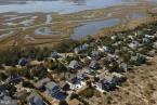
The remnants of Hurricane Ian slowly moved through the Cape Region Sept. 30-Oct. 3, bringing strong winds, rain and localized flooding.
The NWS has issued a high surf advisory and rip current warning through 6 p.m., Sunday, Oct. 2; a coastal flood advisory until 6 a.m., Monday, Oct. 3; and a coastal flood watch until 8 p.m., Monday, Oct. 3. Tides are expected to be several feet over normal Oct. 3 and Oct. 4 causing widespread flooding, especially in areas bordering inland waterways.
A wind advisory, with sustained winds of 15 to 25 mph and wind gusts up to 50 mph, has also been issued from 2 p.m., Sunday, Oct. 2 to 4 a.m., Monday, Oct. 4.
For more information go to weather.gov.

The wind drives sand across the main Lewes Beach parking lot. City crews closed off the front section of the lot because of drifting sand. RON MACARTHUR PHOTO

The marsh along Savannah Road in Lewes overflows onto the road Oct. 2 during the first of several predicted higher-than-normal high tides over the next two days. RON MACARTHUR PHOTO

Ocean waves have been crashing relentlessly on the outer breakwater and the Harbor of Refuge Lighthouse. RON MACARTHUR PHOTO

While the Cape May-Lewes Ferry operated throughout the day Oct. 1, service stopped on Oct. 2 in advance of high wind warnings from the National Weather Service. RON MACARTHUR PHOTO

About 30 minutes from high tide in Rehoboth Beach, the water is already making its way to the dune line. CHRIS FLOOD PHOTO

Rough seas and high winds batter the dune crossing at the Bethany Beach side of Delaware Seashore State Park. CHRIS FLOOD PHOTO

Erosion will continue along Lewes Beach during periods of high tide over the next three days. RON MACARTHUR PHOTO

Even during periods of low tide, the waves are rolling along the Atlantic Ocean coast at Cape Henlopen State Park. RON MACARTHUR PHOTO

Oak Orchard is experiencing flooding along River Road. CHRIS FLOOD PHOTO

With three hours to go before high tide, the dock out to the Indian River Water Sports Club in Oak Orchard is already covered. CHRIS FLOOD PHOTO

Stormy weather, high waves and wind don’t stop ship traffic in the Delaware Bay and Atlantic Ocean. RON MACARTHUR PHOTO

The Lewes-Rehoboth Canal flows over into the marsh adjacent to homes on Cedar Street in Lewes during one of four or five more excessive high tides predicted Oct. 3 and 4. RON MACARTHUR PHOTO

A car passes through a flooded section of Cedar Street in Lewes on Oct. 2. RON MACARTHUR PHOTO

Waves break on the jetty at Roosevelt Inlet in Lewes. RON MACARTHUR PHOTO

As Rehoboth Avenue shows, weather like this makes for good shopping. CHRIS FLOOD PHOTO

Cedar Street in Lewes is flooded by rain and water from the Lewes-Rehoboth Canal. RON MACARTHUR PHOTO

Boats along Pilottown Road in Lewes are nearly on the dock as rising canal water pushes over its banks during high tide Sunday afternoon.

Docks along Pilottown Road in Lewes are covered by a rising Lewes-Rehoboth Canal. RON MACARTHUR PHOTO

Strong winds are bringing in smells from all over the place. CHRIS FLOOD PHOTO

The wind ruffles the white feathers of this bald eagle trying to eat off Beaver Dam Road. CHRIS FLOOD PHOTO

This photo taken during high tide on Read Avenue in Dewey Beach was sent in by Dave Koster of Rehoboth Beach. PHOTO COURTESY OF PORTRAITS IN THE SAND

This young lady may have been the only person who actually stepped into the churning waters of the Delaware Bay along Lewes Beach over the past four days. RON MACARTHUR PHOTO