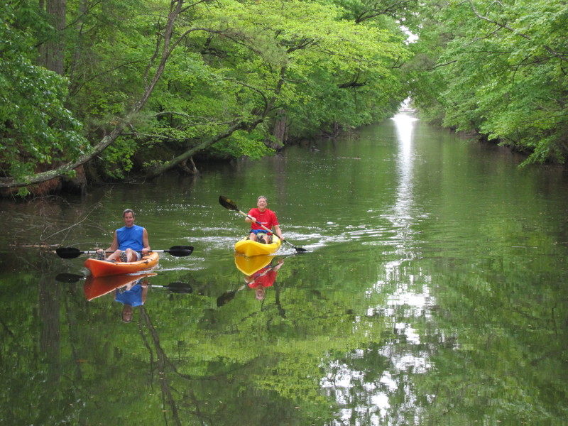
A nice, easy passage through Assawoman Canal
25 May 2011
Two weekends ago, Becky and I loaded Nellie Lankford with the bare essentials and headed south from the launching ramp in Lewes toward the Inland Bays. Observing the no-wake signs, it takes an hour and a half from Roosevelt Inlet in Lewes to the southern canal entrance at the northern end of Rehoboth Bay. For those in no hurry, it's a sweet ride: through the city of Lewes, along the marshes of the capes, through North Shores and Henlopen Acres, under the drawbridge of Rehoboth with the rubber-on-metal sounds of cars passing over, and on southward past the Rehoboth Beach wastewater treatment plant (you'd hardly know it's there if you didn't know it was there), Bay Vista and Thompson Island.
The contrast from the confines of the canal to the wide open waters of Rehoboth Bay is almost palpable, especially when the wind is blowing out of the south or the east. I'm never unimpressed by the beauty of the Rehoboth Bay system. How lucky we are. And I always remark how charming and attractive Dewey Beach is from the water. Especially notable is the fact that the buildings barely, if at all, rise above the height of the town's tallest trees. It's a very human scale and I don't think the new building proposed for Ruddertown will disturb that feeling much. The lighthouse will still beckon and it will always be fun to cruise slowly toward the bay beach thinking about the cold beer or juicy burger that awaits in so many places.
But this wasn't a Dewey weekend. We were headed for points south.
The Assawoman Canal (Assawoman is an Algonkian word meaning, roughly, midway fishing stream) makes its way from White's Creek to Little Assawoman Bay. White's Creek forms the western side of Cedar Neck, north of Ocean View, and is an offshoot of Indian River Bay. Little Assawoman Bay is at the very southeastern corner of Sussex County, west of South Bethany and Fenwick Island.
The summer marks are up in Massey's Landing so making your way through from Rehoboth Bay to Indian River Bay is a fairly simple matter now. You go through Massey's Ditch, past the launching ramp at Massey's Landing, and then follow the marks across Indian River Bay into White's Creek. You have to have charts and you have to know how to navigate because Massey's Ditch and the Inland Bays are filled with shoals that can run you aground in a heartbeat.The entrance to Assawoman Canal is just past green marker 13 in White's Creek. The colorful houses at Sunset Harbor make for a easy landmark at the canal's entrance.
It's a slow, no-wake cruise through the canal which, until last winter, was impassable due to logs and shoaling. Now the canal is open for small craft - those that don't draw any more than three feet nor rise above the water line more than six or seven feet. Draft is always a concern as is passage beneath the three bridges that cross the canal. The state just finished a 20-year dredging project - permits and work - and have made the canal useful once again.
We made the passage at mid- to low-water and never bumped once. Nellie draws about two feet. Our depth sounder registered three feet to seven feet at various places in the canal and we had three and four feet of clearance under the bridges. Nellie rises about six and a half feet above the water.
The passage is serene and green with trees completely arching the canal along most of its length. Passage of the canal takes about an hour. You can't make more than about four or five knots while still respecting the no-wake requirement.
At the south end, the canal makes its way through a couple of interesting hardwood and marshy islands before opening out into the shallow Little Assawoman Bay. The state has its marking system in good shape for the summer season. To the west are the dunes and occasional seaside residential communities that stand between Delaware Seashore State Park and Fenwick Island State Park. To the east are Miller and Dirickson Creeks and, between them, the extensive and wild Assawoman Wildlife Refuge system.
Little Assawoman Bay ends at the Fenwick Island Cut, crossed by the Delaware-Maryland state line and Route 54. You can keep on southward into Maryland and the broader Assawoman Bay to the west of Ocean City. Or, like us, you can tie up at the dock of Catch 54 Restaurant and eat some lunch or dinner. The restaurant is set up nicely to enjoy the outdoor setting along the water and marshes.
Down and back is a full day, even if you start early. Better, if you can, to spend a night on the water in one of the little coves of Rehoboth Bay and wake to the sound of the sea gulls singing their way to work, inland, from their marshy roosts along the coast.


