Coaches, weather delays and an El Niño watch

Former Lewes High School football and baseball coach Tony Georgiana rolled into town recently to celebrate his 93rd birthday and swap smiles and hugs with some of his former players and friends. They gathered at the Greene Turtle in the Villages of Five Points to share stories of the glory years when Georgiana and his lifelong friend Don Hanley were posting championships in baseball and football which they co-coached. Two Major League Baseball players - pitchers Chris Short and Johnny Morris - developed under the coaches. In 2001, Cape Henlopen School District named the stadium at Cape Henlopen High School Legends Stadium in honor of Georgiana, Hanley, Don Edgerton and Frank Coveleski. “Everybody had a good time getting together with Coach,” said Charlie Howard.
Winter storms delay projects
This past winter’s persistent storms did more than just boost sales of salt, sand and booze. They also set back two significant projects in Cape Henlopen and Delaware Seashore state parks. Regional parks administrator Pat Cooper said the $10 million campground, promenade, parking lot and pavilion project at Indian River Inlet is at least a month behind schedule. So too is the connector trail project between Gordons Pond and Herring Point at Cape Henlopen.
“The contractors told me that each storm meant at least a three-day setback,” said Cooper. “Each time they had to reset. But now that the winter weather has broken, they’re really starting to move.”
He said Delaware Seashore had been taking camping reservations for August through December, holding off on any earlier reservations until a clearer picture was available as to when the new campground on the south side of the inlet will be ready. “I think we will have some areas open to camping in early June, so we’re now taking reservations starting in mid-June. “The biggest pieces are parking lots and campgrounds. The contractor is going to focus on the south side of the inlet first. Construction will continue through the summer, with the fancy walkways and pavilions on the south side getting attention after the campground is open. Then we’ll get to the restrooms on the north side of the inlet and in the fall, the campground there.”
In Cape Henlopen State Park, Cooper said, the framers working on the boardwalk section of the Gordons Pond connector trail are hustling to get done so the decking and final surface for the trail can be installed. “That project is about a month behind,” said Cooper. “I think they will be done in late May or early June.” He said some roads in the Herring Point area of the park will have to be closed for a few days in late May to accommodate repaving in that area.
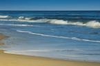
El Niño weather pattern forming
We may be in for a cooler-than-usual summer with lower-than-average hurricane activity if an El Niño weather pattern forming in the tropical portion of Pacific Ocean comes to full bloom. El Niño refers to the Christ child, and the name was given more than a century back to a weather occurrence that brought warmer temperatures just before Christmas to the western coast of South America.
Now it’s known that the phenomenon is much larger than just a local event and can ultimately affect our weather along the East Coast.
University of Delaware College of Earth, Ocean and Environment scientist Dr. Matt Oliver said air pressure and sea surface temperature anomalies can signal the onset of an El Niño event. Such events last for several months. “It’s about time for one,” said Oliver. “The last ones we had were in 1997 and in 1983 before that.”
He said El Niños come down to big, global-level sloshing events. He said the water in the tropical Pacific basically sloshes, very slowly, between South America and Asia. When a wave of warmer-than-average water begins making its way from west to east, which appears to be happening now, an El Niño can form. When that warm water wave comes up against the South American coast - all very gradually over months - and then reverses itself, heading back toward Asia, it can leave cooler-than-usual water behind, which is called, conversely, an El Niña. In addition to affecting weather on a large scale, Oliver said, such events can also lead to a deepening or a shutdown of ecosystem productivity. The deepening of the ecosystem productivity has played a role in the El Niño label for the event because South American fishermen over decades noticed that their fish harvests went up noticeably in parallel with such large-scale weather patterns. That, for them, was a gift, as was the Christ child.
Dr. Jeff Masters, founder of the Wunderground.com weather site, has mentioned the emerging El Niño event a few times in recent blogs. Last week he featured a “very technical” discussion by Dr. Michael Ventrice, an operational scientist at Weather Services International. At the conclusion of many paragraphs with terms like southern oscillation, oceanic Kelvin waves, downwelling and thermoclines, Ventrice concludes: “The Pacific Ocean continues to show signs of a developing moderate to strong El Niño event. During strong, full-basin El Niños, we often observe cooler-than-average temperatures in summer across the eastern two-thirds of the U.S. and lower-than-average Atlantic hurricane activity.”
Ventrice also noted that the national Climate Prediction Center has issued an El Niño watch. An Accuweather post notes that when El Niños extend into the winter - as in, possibly, next winter - they can result in more and wetter southern storms that can track up the East Coast.
One thing’s for sure: we had plenty of practice dealing with them this past winter.