Know Your Flood Risk: New FEMA Coastal Flood Maps Ready for Review Public Open House
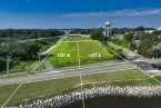
The Federal Emergency Management Agency (FEMA) released updates to the coastal flood maps, known as Flood Insurance Rate Maps (FIRMs), for Wicomico County. These updates were preliminarily issued to Wicomico County and the incorporated areas on July 26, 2013. The FIRMs indicate flood-prone coastal areas in Wicomico County, and insurance companies use FIRMs to determine flood insurance rates for buildings and contents. Wicomico County residents and property owners are encouraged to learn more about their flood risk and the updates shown on the preliminary maps.
A public Coastal Flood Risk Open House will be held at the Wicomico Youth and Civic Center - DaNang Room on Thursday, July 17, 2014 from 5:30 pm – 8 pm. Using interactive flood maps at this Open House, representatives from the State, County, and City of Salisbury, as well as FEMA and their mapping partners, will be available to answer flood risk and insurance questions, and explain the preliminary maps.
Flooding is the number one natural disaster in the United States; it is vital for property owners to understand their risk, and take advantage of tools and programs available to them, including flood insurance, to help reduce flooding impacts.
The preliminary maps that will be shared at the Open House are an update of the existing FIRM, which dates back to 1984. These preliminary FIRMs and the associated Flood Insurance Study (FIS) provide the basis for flood risk education and floodplain management measures. Wicomico County is required to adopt updated maps to continue participating in the National Flood Insurance Program (NFIP), which makes flood insurance available to the community.
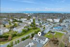
As a result of these map updates, some buildings in Wicomico County may, for the first time, be included in a high-risk flood zone, known as the Special Flood Hazard Area, or SFHA. This may result in mandatory purchase of flood insurance for those property owners who are affected. FEMA staff will be at the Open House and will be available to talk to property owners about these updates and what it means to them.
Additional information is available at www.wicomicocounty.org or www.ci.salisbury.md.us and more information, including links to the interactive mapping website, can be found on www.R3Coastal.com.
Residents with additional questions can contact the Wicomico County Department of Planning and Zoning at 410-548-4810 or The City of Salisbury Department of Building, Permits and Inspections at 410-548-3170.