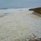
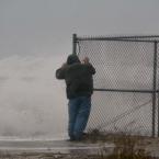
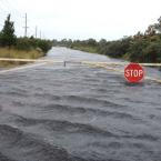
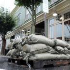
A nor'easter-like system has drenched the Cape Region as a coastal flood warning for Kent and Sussex counties continues through 6 p.m. Sunday, Oct. 4.
Updated weather forecasts show Hurricane Joaquin coasting past the East Coast, and Tom Kines, Accuweather senior meteorologist, said it's unlikely the Delmarva region will feel its full force.
Gov. Jack Markell issued a limited state of emergency in Sussex County Oct. 2 due to coastal flooding and high wind warnings along the coast.
State offices remained open and no driving restrictions were issued, but localized road closures are in effect. A coastal flood warning for Kent and Sussex counties is in effect until 6 p.m., Sunday, Oct. 4.
Sussex County road closures:
- Primehook Road in Milton
- Route 16 from Route 1 to Broadkill Beach
- Front Street in Milton
- River Road in Oak Orchard
- Long Neck Road
- Falling Point Road between Route 26 and Sussex 343
- Slaughter Beach draw bridge
Water on road warnings for:
- Oyster Rock Road (near end of road)
- Cods Road at Sussex 221, Milford
- 13 Curves Road at Cods Road, Milford
- Lighthouse Road at Route 36, Milford
- Camp Arrowhead Road
- Banks Road between Sussex 38 and Route 24, Millsboro
- Plantation Road between Sussex 38 and Dead End
- Route 24 near Giant grocery store
- New Road at Canary Creek Bridge
- Fred Hudson Road, between Route 1 and Road 357 in Bethany Beach
RELATED LINKS »
Gallery of reader submissions
Real Time DelDOT traffic cameras at Indian River Inlet Bridge
The Delaware Department of Transportation closed Route 1 southbound and northbound between Bethany Beach and Dewey Beach on Oct. 2 and Oct. 3, but opened the road to traffic about 10 a.m. Oct. 4.
Route 1 will see intermittent closures in this area throughout the storm.
If this coastal portion of Route 1 closed, a detour route will send northbound motorists to westbound Route 26, to northbound Route 113, to eastbound Route 24 back to Route 1. Southbound motorists should take westbound Route 24, to southbound Route 113, to eastbound Route 26 back to Route 1.
Local officials also are in storm mode, and the ongoing rain and high winds continue to push water landward, flooding low-lying areas. State and county officials warn residents storm warnings were in effect through early Saturday.
In Dewey, flooding associated with the storms means measuring sticks installed a year ago on bayside streets will get used for the first time to measure the depth of flood water.
Marc Appelbaum, Dewey town manager, said town officials are much more concerned about bayside flooding than storm surge breaching oceanside dunes, because there's a couple hundred feet of beach and the dune is 5 feet tall.
“There’s no buffer on the bayside,” he said, so streets flood.
Appelbaum said the measuring sticks were installed so the depth of flooding can be monitored. He said pictures of Read Avenue show a sheet of water during most events, but there’s no indication of how deep the water is.
“It’s tough to tell if it’s 3 inches or 30 inches,” he said. “Unless you know, you don’t know.”
The University of Delaware's Delaware Environmental Observing System has reported that Rehoboth Beach received almost 4 inches of rain in a 24-hour period on Oct. 2. Around noon Oct. 2, wind speeds were just over 23 miles per hour, heading in a northeasterly direction, with peak gusts reaching nearly 33 miles per hour. Rehoboth received about a half inch of rain Oct. 3.
Accuweather predictions
Tom Kines, Accuweather senior meteorologist, said Oct. 1, “Even without a hurricane, there’s going to be a lot of rain."
Kines said the addition of strong, sustained winds means there’s no way to avoid coastal flooding.
“This system won’t bring historic levels of flooding, but if you own a property that would normally be susceptible to flooding, it’s something to be concerned about,” he said.
Kines said Oct. 2 Delmarva residents most likely won't feel the effects of Hurricane Joaquin, which forecasts now say is highly unlikely to hit the Mid-Atlantic or Southeast Coast.
“The winds are pretty strong out of the northeast, and it's going to stay that way probably throughout the weekend, but it's not related necessarily to the hurricane,” he said. “It's going to be a strong hurricane at least through tomorrow, if not Sunday as well, though it is trending farther and farther away from the coast.”
An upper level system that is catching up with the slow-moving hurricane is expected to act like a wall, reflecting Hurricane Joaquin and pushing it east out into the Atlantic Ocean, he said.
Kines said residents should expect heavy rain through Oct. 2, with some lighter rain throughout the weekend. It should start to dry out early next week, he said.
Kines said Oct. 1 as prediction models show Joaquin moving offshore, the storm needs continual monitoring, but on Oct. 2 said he is more confident in the accuracy of projections that show Joaquin staying at sea.
A surging ocean
Chris Bason, executive director at the Delaware Center for the Inland Bays and Ocean View resident, said the end-of-week storm has brought the usual flooding to coastal areas.
The center office, at Inlet Road at Delaware Seashore State Park, was accessible the morning of Oct. 3, Bason said, but he is has seen significant erosion.
When the rainclouds clear, Bason said, severe beach erosion, especially at the Indian River Inlet, is likely.
"It is still ripping down there, howling," he said. "The ocean is just really surging."
However, Bason said, the flooding has not been as bad as some other storms, including Superstorm Sandy.
Delaware Seashore State Park closed Friday
Delaware Seashore State Park closed dune crossings Oct. 1 and announced the park would be closed Friday, Oct. 2.
Ray Bivens, Delaware State Parks director, said, “What we pay close attention to is winds, once they are expected to reach a certain level, or if we have a mandatory state of emergency, we do force visitors to leave and refund reservations.”
Equipment is moved from flood-prone or potential tree-falling zones, and equipment needed after a storm – chainsaws, chippers, four-wheel-drive vehicles – are gassed up and easily accessible, Bivens said.
To be on the safe side, Bivens said, irreplaceable artifacts may be removed from locations like the Indian River Lifesaving Station. Many of our parks' large parking areas are also designated as debris deposit areas, he said. So far, it has never happened, he added, but it is part of advanced state planning efforts.
Dewey Goes Pink rescheduled
Dewey Goes Pink has been rescheduled for Saturday, Oct. 10. All the times associated with the event remain the same.
Steve Montgomery, Starboard owner and event organizer, said in an email Sept. 30 that more than 2,300 people had registered for the event. He said refunds on registrations are available, but 100 percent of unrefunded registrations will go towards the Delaware Breast Cancer Coalition.
Coast Day cancelled
Citing a public safety concern, the University of Delaware’s Coast Day, set for Sunday, Oct. 4, has been cancelled. The event is usually rain or shine.
“We are using the tools and science that we have available at the present time to make a decision that best protects the safety of our visitors, faculty, staff, and students,” said Mohsen Badiey, acting dean of the College of Earth, Ocean, and Environment, in a prepared statement. “Coast Day typically draws nearly 10,000 visitors to Lewes, and it would be irresponsible to encourage attendance in the face of unpredictable weather.”
Boast the Coast events cancelled
The Lewes Chamber of Commerce has cancelled a number of events for the Boast the Coast event, scheduled for Saturday, Oct. 3.
Betsy Reamer, chamber executive director, said boat tours at city dock, the 4 p.m. boat parade and activities in 1812 Park have been cancelled.
Reamer said no rain date is scheduled.
Other events cancelled
Many weekend events have been cancelled. Check capegazette.com for a full list of cancellations.


