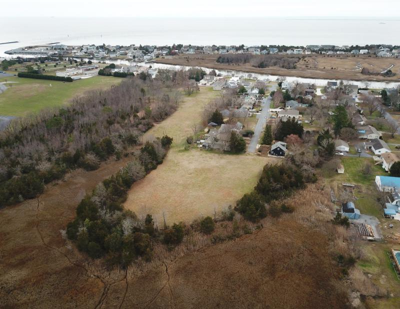
A new study shows the proposed Fisher's Cove subdivision in Lewes will likely increase flooding in the surrounding area during a major storm. Other developments, including Lewes Waterfront Preserve and Harbor Point, would cause less disruption, the study shows.
Betsy Hicks of consultant AECOM used five models to simulate flooding conditions in areas surrounding two proposed projects in Lewes – Fisher's Cove, an 18-home community off Rodney Avenue, and Lewes Waterfront Preserve, a 90-unit townhouse community off New Road near the Canary Creek bridge. Also included was Harbor Point, a 69-lot subdivision under construction along the Great Marsh off Park Road near the University of Delaware wind turbine.
Hicks’ models showed increased flooding immediately surrounding Fisher's Cove, likely due to the proposed grading of the project.
“A lot of the homes on the northern side of Rodney Avenue are draining into the Great Marsh via a little ditch that runs behind those homes,” she said.
Proposed grading fills in the ditch, she said.
“Now the homes in that area would have to rely upon the storm drain system to drain the water,” she said. “It’s less efficient, so you’re seeing a little more buildup of water.”
She said it’s possible the projections could change as the Fisher's Cove plan for grading and stormwater management evolves.
Tim Tice with Fisher's Cove developer Burke & Rutecki LLC said the report will be a good tool to better shape the development.
“We look forward to continuing to work with the city engineers, the Board of Public Works and the Sussex Conservation District to put together a final plan,” he said. “The hydrology report will inform that effort, so the information provided in the report is appreciated.”
Overall, Hicks’ models found only a slight increase in flooding throughout the basin – in most cases, an inch increase.
“It’s not huge, but it does indicate a pattern that the area is not an infinite resource that can absorb changes to the land cover and changes to the storm drain pattern,” she said.
Six scenarios combining storms of varying magnitudes, rainfall events and sea-level rise were evaluated – three under present-day conditions without sea-level rise, and three based on future conditions plus 1.33 feet of sea-level rise.
Hicks also ran Lewes Waterfront Preserve through the models and found no significant increase in flooding post development.
“The area upstream is a much larger basin [than Fisher's Cove],” she said. “Because of that, it is able to absorb these changes … without having a noticeable increase in flooding.”
Land use is important, she said.
“A densely vegetated marsh provides more frictional resistance and can slow the flow of water more effectively than a concrete or asphalt surface,” she said.
Other factors taken into consideration include soil characteristics and existing stormwater systems.
To validate the models, Hicks used a storm in January 2016. The flooding results from each model were compared to photographs provided by residents and those that appeared in the Cape Gazette. Hicks said the comparison showed the models were accurate.
Deputy Mayor Fred Beaufait said he found the report useful.
“You validated many things many of us suspected were true,” he said. “With this information, we have a better foundation for making comments and decisions.”
This story originally posted 07/29/19 and has been refeatured.
Nick Roth is the news editor. He has been with the Cape Gazette since 2012, previously covering town beats in Milton and Lewes. In addition to serving on the editorial board and handling page layout, Nick is responsible for the weekly Delaware History in Photographs feature and enjoys writing stories about the Cape Region’s history. Prior to the Cape Gazette, Nick worked for the Delmarva Media Group, including the Delaware Wave, Delaware Coast Press and Salisbury Daily Times. He also contributed to The News Journal. Originally from Boyertown, Pa., Nick attended Shippensburg University in central Pennsylvania, graduating in 2007 with a bachelor’s degree in journalism. He’s won several MDDC awards during his career for both writing and photography. In his free time, he enjoys golfing, going to the beach with his family and cheering for Philadelphia sports teams.


