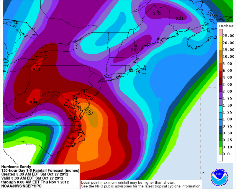
Ths National Weather Service issued a Coastal Flood Watch at 7:48 a.m. today for Coastal Areas of Delaware including the Bay and the Tidal Delaware River. A watch means conditions are right for dangerous weather.
• Coastal flooding - Moderate to major coastal flooding is anticpated within 2-3 hours either side of the high tides Sunday evening and again Monday morning-midday. This will be long duration tidal flooding and probably road closures and potential for damage where water encroaches on parking lots and buildings
• High tides - At Lewes, Delaware, the times of high tide are 8:38 p.m. Sunday and 8:55 a.m. Monday.
• Seas - Along the Atlantic Oceanside of Delaware, seas will be 15 to possibly 20 feet, while in the lower Delaware seas will be 6 to 10 feet and the upper part of Delaware Bay between 2 and 4 feet. This added over-wash will pose considerable threat to beachfront properties.
• Rainfall - 4 to possibly 8 inches of rainfall by noon Monday will add to the local stream flow on the tidal Delaware increasing the odds of major flooding
• Duration - Moderate or greater tidal flooding may last 3 to 5 hours during the high tide cycle
• Precursor flood episode - Minor coastal flooding is likely during the Sunday morning-midday high tide but that will be dwarfed by what follows Sunday night and Monday
For a list of the impact of different tide heights in your county go to weather.gov/phi/tides.htm.


