FloodVision takes a spin through Milton


A new tool aimed at helping government officials, homeowners and business owners better plan for future flooding events made its way through Milton the week of May 23.
FloodVision is a product of the national nonprofit group Climate Central, whose specialty is climate science. Climate Central has partnered with Delaware Sea Grant to begin using FloodVision across the state, hosting a kickoff event at Milton Memorial Park May 15.
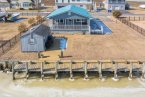
The FloodRover, a car with cameras mounted to the roof, drives around taking images of areas prone to flooding. The technology is similar to how Google Maps data is compiled. After images are taken, FloodVision models what that image would look like with flooding at different levels, plugging in data from recent thunderstorms, hurricane storm surges and different floodplain years.
Allison Kopicki of Climate Central said the goal of the technology is to allow for better planning in areas prone to flooding.
“We’re capturing what it looks like during the storm before the storm hits,” she said. “We can give people time to see the future in order to shape their future.”
Kopicki said data has been captured in Wilmington, Lewes and Rehoboth Beach, and Milton was next on the list. She said the data can help inform decisions about elevating buildings, insurance needs, evacuation routes and emergency management.
“It gives people a sense of where the water will go [and where] we shouldn’t be putting people in the event of a big storm. And a picture tells a lot more than a map. It makes a big difference,” Kopicki said. “These are hard conversations, but people should start having them.”
Danielle Swallow of Delaware Sea Grant said, “Delaware is the lowest-lying state. We have low elevation. Towns like Milton, the heart of their downtown is in the floodplain. We need to come up with new tools to help them. We find visuals to be a really effective communications tool. People have a hard time equating sea-level rise with what it means to them. So FloodVision gives us an opportunity to provide a photorealistic visualization of their town theater, their library or their evacuation route, and they can see how they will be impacted.”
Swallow said Sussex County and Delaware Department of Natural Resources and Environmental Control are on board with the technology as a tool in future planning. She said for a municipality like Milton, FloodVision can be helpful for future grant applications and for selling the citizenry on the need for flood mitigation.
Swallow said once Climate Central completes taking pictures, the next step is to process that data and then hand it to Delaware Sea Grant, which will develop an archival system for it. She said that work will likely be completed in the summer.

Ryan Mavity covers Milton and the court system. He is married to Rachel Swick Mavity and has two kids, Alex and Jane. Ryan started with the Cape Gazette all the way back in February 2007, previously covering the City of Rehoboth Beach. A native of Easton, Md. and graduate of Towson University, Ryan enjoys watching the Baltimore Ravens, Washington Capitals and Baltimore Orioles in his spare time.