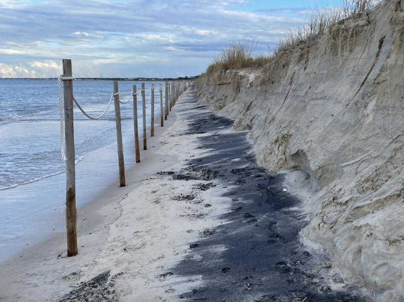
The City of Lewes has hired former Department of Natural Resources and Environmental Control Shoreline and Waterway Management Administrator Tony Pratt to analyze and advocate on behalf of the city regarding chronic beach erosion issues.
Pratt says the erosion problems can be traced back to the 1930s, when the U.S. Army Corps of Engineers created Roosevelt Inlet by dredging through the barrier island and creating two jetties. This action disrupted the natural flow of sand west to east along Lewes Beach.
By the 1950s, the beach near Roosevelt Inlet was so badly eroded that houses were on the edge of the bay and in danger of collapse. In response, the Army Corps and Highway Commission pumped a large quantity of sand onto the beach.
“Thus began a decades-old cycle of sand loss, replenishment, followed by sand loss,” Pratt said in his proposal.
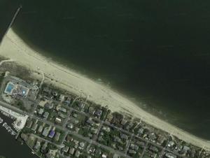
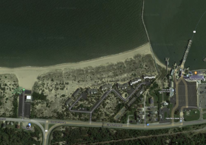
In addition to the Roosevelt Inlet jetty on the west end, Lewes Beach is bound on the east side by the Cape May-Lewes Ferry breakwater. As a result, Lewes Beach has three defined zones.
Due to the jetties at Roosevelt Inlet, the western end of the beach is losing sand that is moving eastward. That sand is being stopped at the ferry breakwater, resulting in beach growth of about 11 feet per year in front of the Pilot Point community. The middle section of Lewes Beach remains relatively stable, with occasional dune growth followed by erosion.
The Army Corps was originally authorized to nourish the entire beach from Roosevelt Inlet to the ferry breakwater, but at some point it was limited to the 1,400 feet immediately east of the Roosevelt Inlet jetty.
Pratt says the sheet steel jetty that was in place at the inlet prior to 2004 was so porous that waves driven by strong northwesterly winds carried sand immediately east of the jetty farther east, making the area in front of the Lewes Yacht Club a feeder beach.
When the more robust existing rock jetty was installed, he said, the feeder area of the beach moved farther east.
Pratt is offering to provide his knowledge and personal connections to assist in remedying the erosion problems and reduced storm protection along Lewes Beach.
Immediate work will be with DNREC to fortify scarped dunes, and provide improved protection for beachfront homes and infrastructure against inevitable future coastal storms.
A longer-term goal is to work with Congress and the Army Corps of Engineers to expand nourishment boundaries back to the original length from Roosevelt Inlet to the ferry jetty.
Pratt’s scope of work will also include working with DNREC to gain commitment to address future storm damage to the beach and dune that occurs between the Army Corps’ prescribed five-year nourishment projects.
Pratt’s fee is $150 per hour. Per his proposal, he expects to work three to six hours per month over the course of three to four months.
“This proposal is very sound as far as I’m concerned,” said Councilman Khalil Saliba.
Saliba has asked that Pratt also consider studying other mitigation strategies such as sea walls that may be used to prevent further beach erosion.
“I think many of us are concerned that this perpetual, unsustainable beach replenishment of constantly pumping sand has to be somehow mitigated or assisted with other measures,” he said.
Nick Roth is the news editor. He has been with the Cape Gazette since 2012, previously covering town beats in Milton and Lewes. In addition to serving on the editorial board and handling page layout, Nick is responsible for the weekly Delaware History in Photographs feature and enjoys writing stories about the Cape Region’s history. Prior to the Cape Gazette, Nick worked for the Delmarva Media Group, including the Delaware Wave, Delaware Coast Press and Salisbury Daily Times. He also contributed to The News Journal. Originally from Boyertown, Pa., Nick attended Shippensburg University in central Pennsylvania, graduating in 2007 with a bachelor’s degree in journalism. He’s won several MDDC awards during his career for both writing and photography. In his free time, he enjoys golfing, going to the beach with his family and cheering for Philadelphia sports teams.


