Lewes source water, sea-level rise ordinances on pause

Lewes officials have decided to take a step back on controversial ordinances that would limit lot coverage and impose other building restrictions on hundreds of properties within the city.
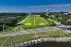
At its May 17 meeting, mayor and city council deferred action on sea-level rise and source water protection ordinances to give council and residents more time to learn and consider potential impacts. Mayor and city council also unanimously voted to enact a six-month moratorium on enforcement of existing restrictive requirements for properties within the excellent recharge area overlay. That means anyone who lives within the defined area who has had a building permit application on hold or anyone who seeks a permit within the next six months is allowed to build to zoning code requirements. Most properties affected by source water ordinance requirements are located in the R-3 zoning district, meaning they can now build to 65 percent lot coverage. Under the more restrictive requirements in the source water protection ordinance, lot coverage was limited to 20 percent, or 50 percent with an environmental impact assessment.
The ordinances became controversial in February when mayor and city council decided, without a vote, to strictly enforce the source water protection ordinance after essentially ignoring it since it was adopted in 2008. Until the May 17 moratorium, residents were told they could adhere to the strict requirements or wait until mayor and city council updated the ordinance.
Work has been underway for several months to revise the source water protection ordinance. In April, Lewes Planning Commission voted 7-2 to recommend approval of a new ordinance that would cap lot coverage at 50 percent and require all driveways, sidewalks, patios and decks to be made of permeable pavement or materials.
Mayor Ted Becker said he did not believe city council was ready to vote on the issue. One reason, he said, is that Carolyn Jones and Khalil Saliba had just joined council after being elected May 8. Secondly, a large contingent of residents voiced opposition at a May 3 public hearing.
“I think we can come back and make a more well-rounded decision,” Becker said. “I think we need to take a good look at this ordinance and come up with something that is not only workable for the community, but meets the environmental concerns we are always trying to address in our efforts to regulate the city.”
Deputy Mayor Andrew Williams said council found itself in a difficult spot.
“Frankly, when I took office I wasn’t aware of the restrictive nature of this provision. So in a sense, I’m giving the folks directly affected by this a moratorium, but I’m also giving myself a moratorium so that we can move forward in a direction that is responsible.”
Councilman Tim Ritzert said it’s an ambitious goal to iron out the details on the ordinance within six months, but deferring a vote is the right move at this time.
“It’s great to have some breathing room,” he said. “This moratorium will accomplish that and keep everyone’s feet to the fire to work toward a successful resolution within the next six months. I look forward to working with the community and council on that.”
More help for sea-level rise issue
Like the source water protection ordinance, mayor and city council deferred action on a proposed sea-level rise ordinance in order for the new council members to get up to speed and offer the community more time to digest the proposal.
Becker plans to create an executive committee to make recommendations on possible amendments to address sea-level rise.
City Manager Ann Marie Townshend said she was recently contacted by Delaware Coastal Programs and the Institute for Public Administration at the University of Delaware to participate in a partnership to start a community engagement process regarding the sea-level rise issue.
IPA will take the lead on facilitating discussions with the goal of working toward consensus on how to address the issues.
Townshend believes it will begin with public listening sessions with trained facilitators. From that the executive committee would be formed. Dates for the listening sessions will be announced soon.
“This is a wonderful opportunity to work with Coastal Programs to help us come to a consensus about sea-level rise and how we want to address it going forward,” Becker said. “It provides a lot of scientific knowledge to us and a lot of university advice regarding how the sea-level rise issue is being looked at throughout the area and throughout the state.”
The city’s proposed sea-level rise ordinance would apply to all properties located within the 100- and 500-year flood plains. Like the source water protection ordinance, the sea-level rise ordinance would limit the amount of impervious surface allowed on a lot.
The ordinance allows 50 percent maximum coverage with the option to increase to 60 percent with implementation of three runoff reduction practices.
All residential property on Lewes Beach, except for a few marine-commercial parcels, is zoned R-3, which currently allows 65 percent lot coverage without any additional requirements. Based on the 500-year flood map, some R-2, low-density residential, and R-5, mixed residential, properties would be subject to the ordinance. R-5 properties already have lot coverage equal to the sea-level rise ordinance, while R-2 currently allows up to 65 percent lot coverage. Some commercially zoned property, which allows up to 95 percent lot coverage, appears to be close to the 500-year flood plain.
The current draft of the ordinance applies to construction of critical facilities and redevelopment of residential property. New residential development will be addressed at a later time. A project is considered redevelopment if it meets the definition of substantial improvement or substantial damage.
The ordinance creates a formula to determine the required height for the first occupied floor. Currently, a home within the flood plain must be raised to the height of the base flood elevation, then an additional 18 inches, known as freeboard. If the proposed ordinance is adopted, a home must also be raised to meet sea-level rise projections 50 years in the future, based on the most recent data available.
Current models project sea-level rise of about 23 inches by 2071. Under the proposed formula, a home would be raised to the base flood elevation, plus 18 inches for freeboard, then an additional 23 inches for sea-level rise.

Nick Roth is the news editor. He has been with the Cape Gazette since 2012, previously covering town beats in Milton and Lewes. In addition to serving on the editorial board and handling page layout, Nick is responsible for the weekly Delaware History in Photographs feature and enjoys writing stories about the Cape Region’s history. Prior to the Cape Gazette, Nick worked for the Delmarva Media Group, including the Delaware Wave, Delaware Coast Press and Salisbury Daily Times. He also contributed to The News Journal. Originally from Boyertown, Pa., Nick attended Shippensburg University in central Pennsylvania, graduating in 2007 with a bachelor’s degree in journalism. He’s won several MDDC awards during his career for both writing and photography. In his free time, he enjoys golfing, going to the beach with his family and cheering for Philadelphia sports teams.