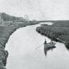
Route 14 bridge over Lewes-Rehoboth Canal in 1970

Lloyd Teitsworth and Dee Andrews made thousands of aerial photographs in the spring of 1970 in an initiative called Project Delaware. This photograph shows the Route 14 (now Route 1) drawbridge over the Lewes-Rehoboth Canal, south of the Rehoboth Avenue drawbridge.
Rehoboth’s State Road is on the right of the canal and about mid-photo, on the left, is the Stokely-Van Camp vegetable canning facility with its tall brick chimney. Farmers for decades would take their vegetable crops to the Stokely facility by way of the Lewes-Rehoboth Canal, which was originally envisioned as a commercial transportation corridor - before the advent of railroads and paved highways.
The double-leaf drawbridge shown here was eventually floated to Lewes to replace the single-leaf drawbridge there. The Route 14 drawbridge was subsequently replaced with the higher fixed bridge that now carries Route 1 traffic southward to Dewey Beach and the coastal highway to Indian River Inlet.