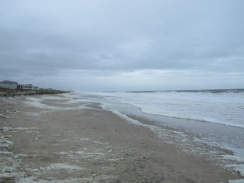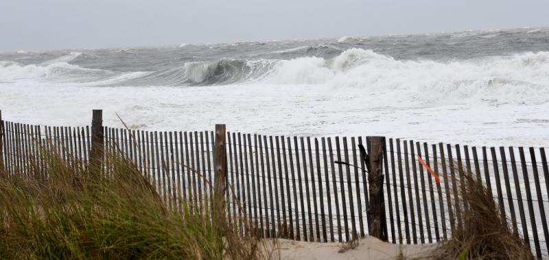












The Oct. 29 storm pounded the dune on Lewes Beach. RON MACARTHUR PHOTO
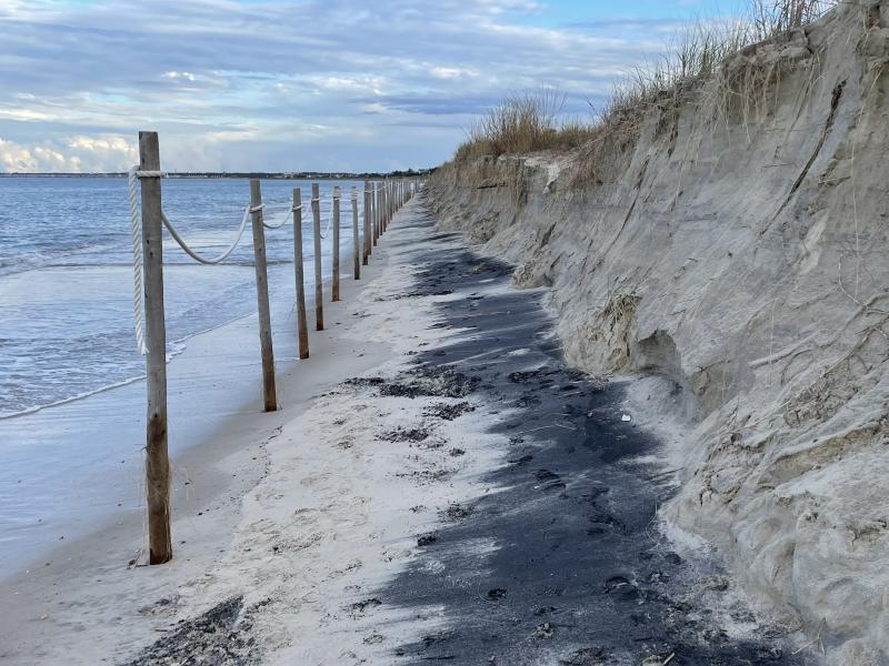
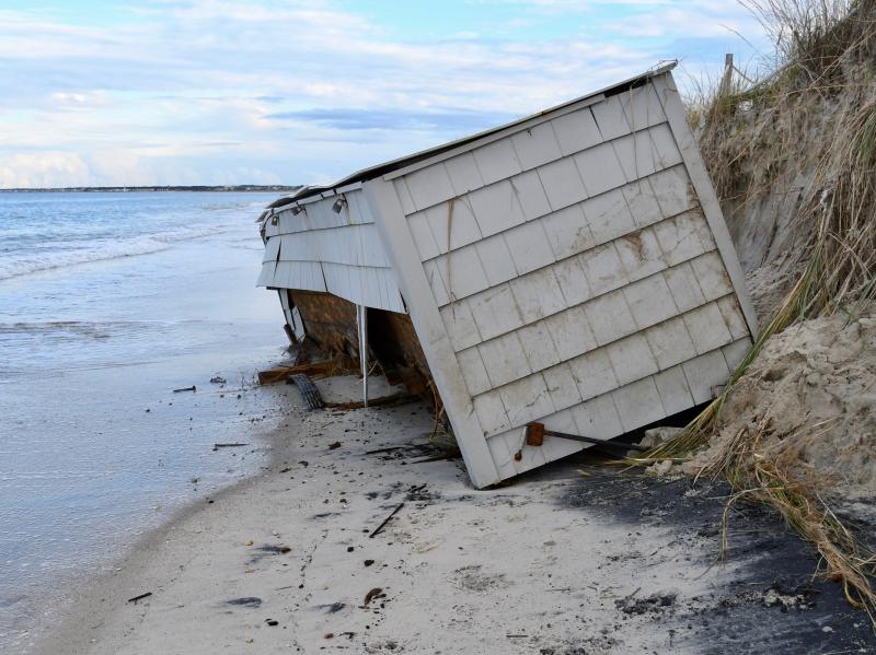
The storm took its toll on Lewes Beach. RON MACARTHUR PHOTO
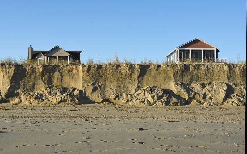
As usual, the beach and large dune in Broadkill kept homes protected. NICK ROTH PHOTO
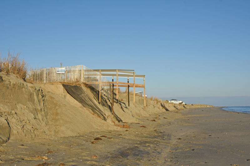
The dune ledge stands about 10 feet high at Broadkill Beach. NICK ROTH PHOTO
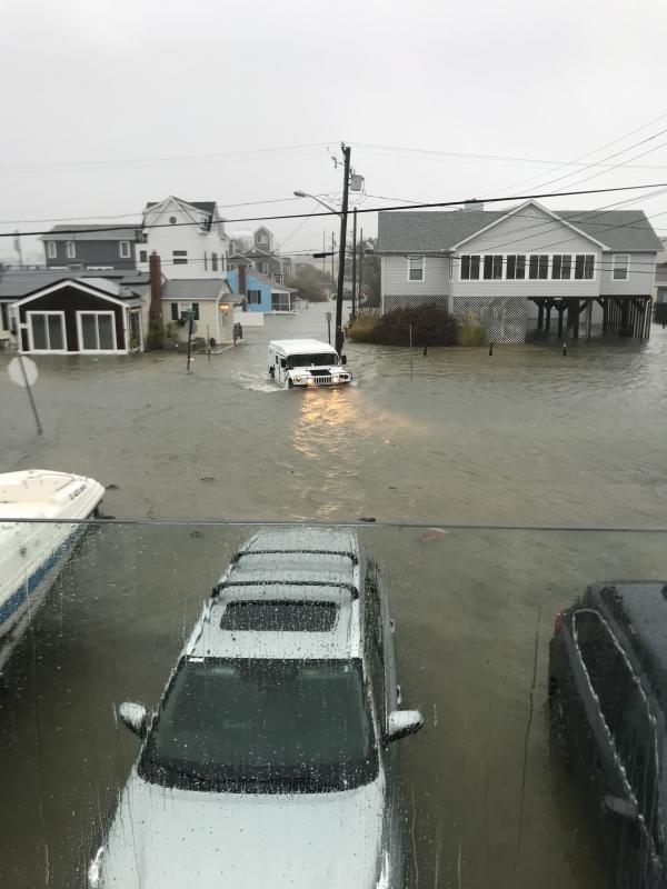
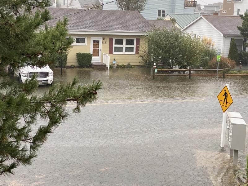
The water level on Read Avenue in Dewey continues to rise Friday afternoon. SUBMITTED PHOTO
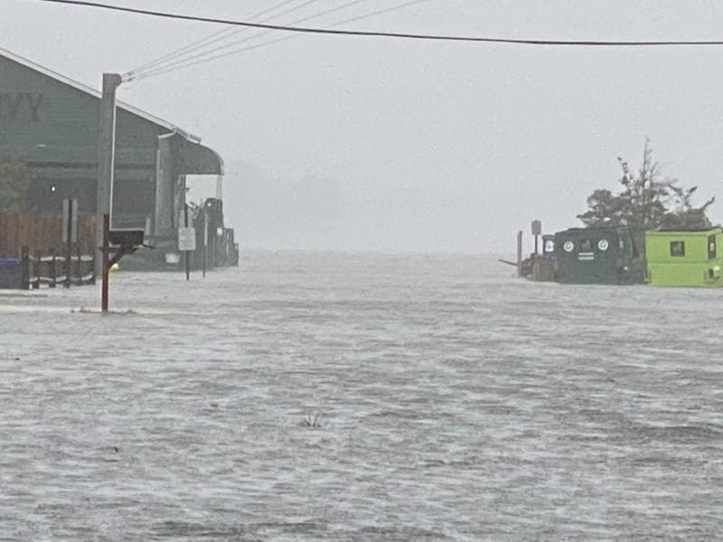
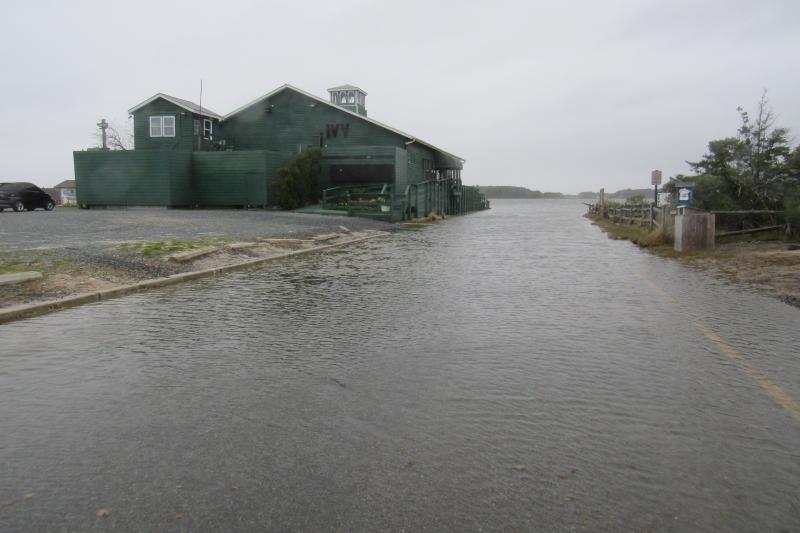
Ivy in Dewey Beach is surrounded by flood water the afternoon of Oct. 29 . SUBMITTED PHOTO
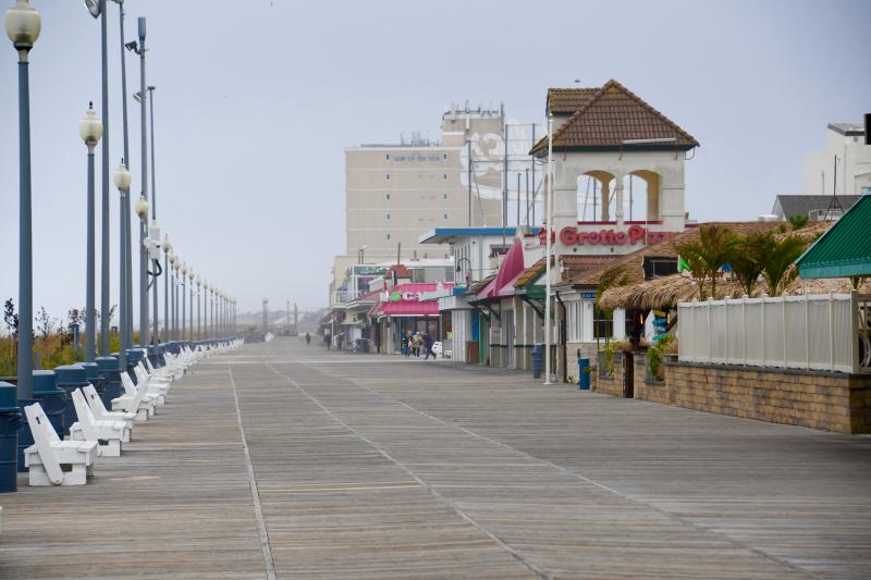
There is not much activity on Rehoboth Beach Boardwalk as all outdoor Sea Witch Festival activities are cancelled Oct. 29 due to terrible weather conditions. RON MACARTHUR PHOTO
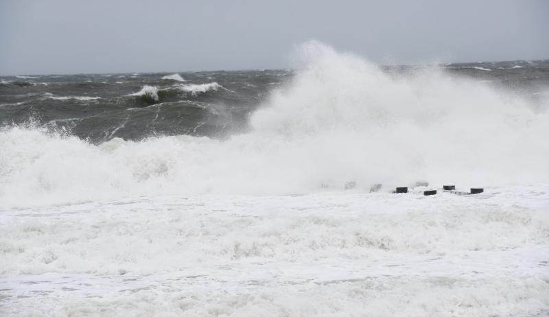
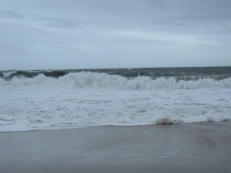
Waves up to 10 feet churn up the Atlantic Ocean along the shores of Rehoboth Beach. RON MACARTHUR PHOTO
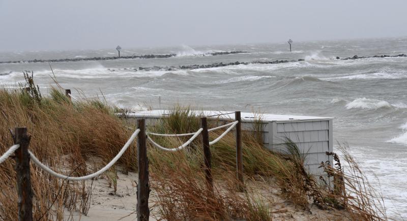
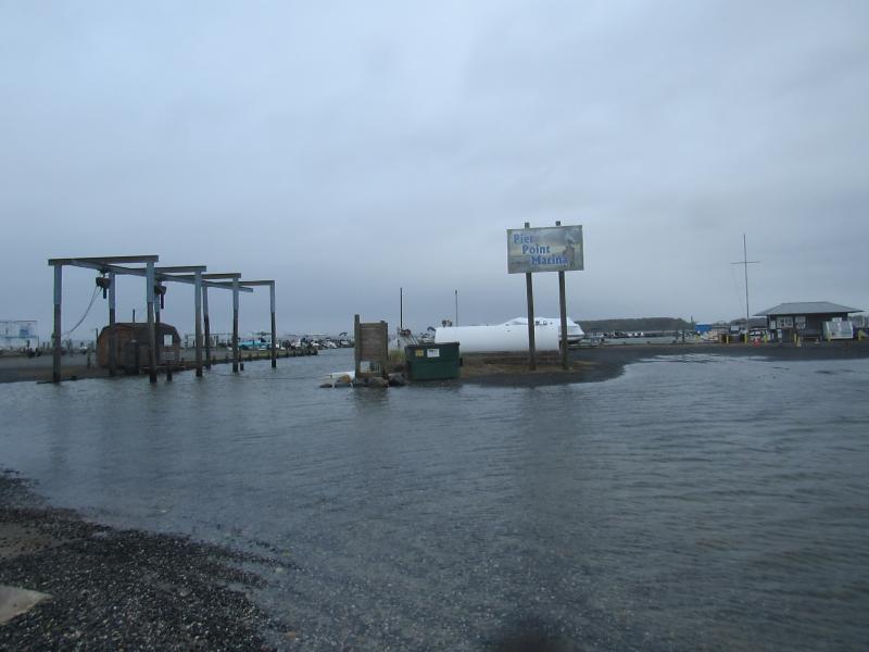
Lewes Beach and Roosevelt Inlet are hit hard by constant waves blown in off Delaware Bay. Significant beach erosion will likely be the aftermath of the Oct. 29 storm. RON MACARTHUR PHOTO
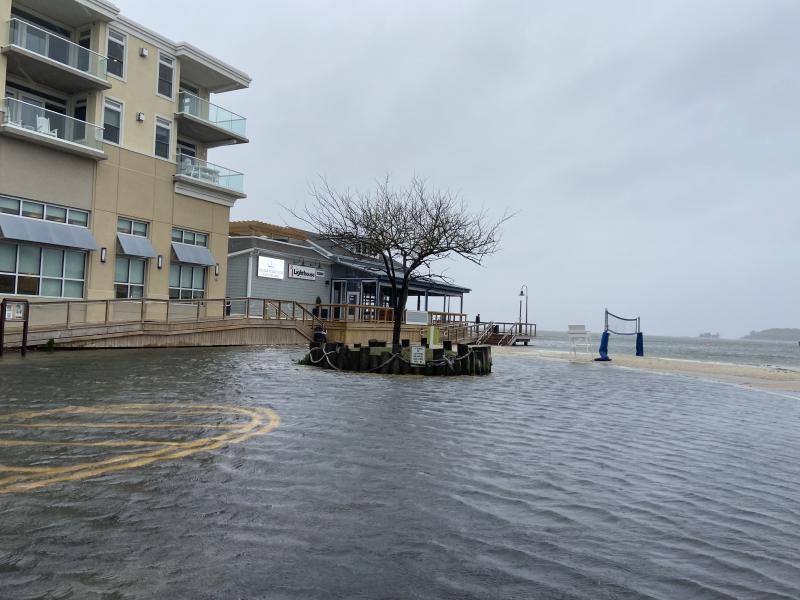
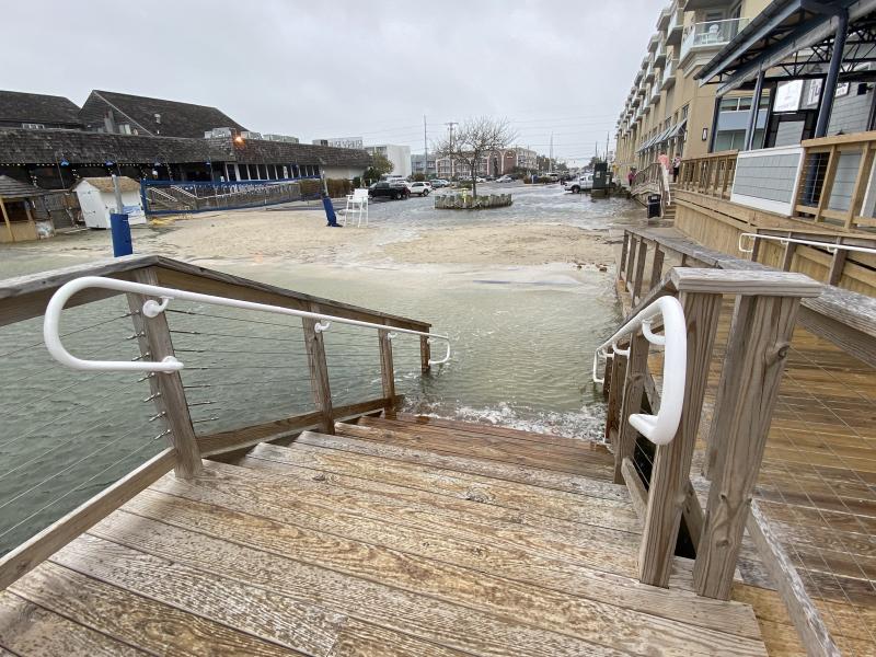
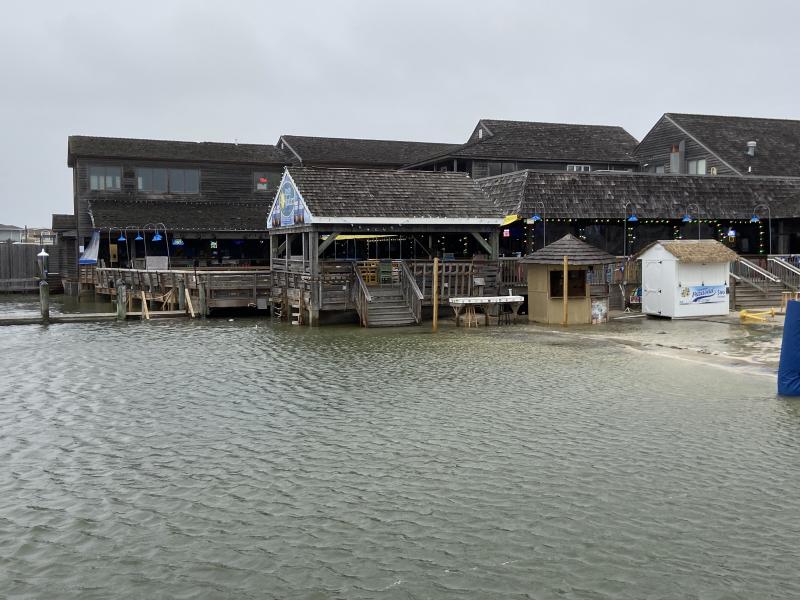
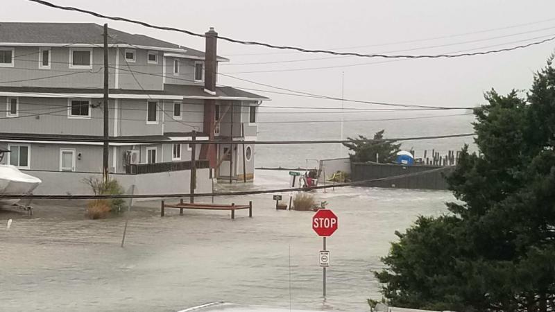
Bay water seeps past the entrance to The Lighthouse in Dewey Beach. The restaurant closed Oct. 29 due to the weather. ELLEN DRISCOLL PHOTO
The entrance to The Lighthouse in Dewey is underwater. ELLEN DRISCOLL PHOTO
Water rises around the Rusty Rudder in Dewey Beach. ELLEN DRISCOLL PHOTO
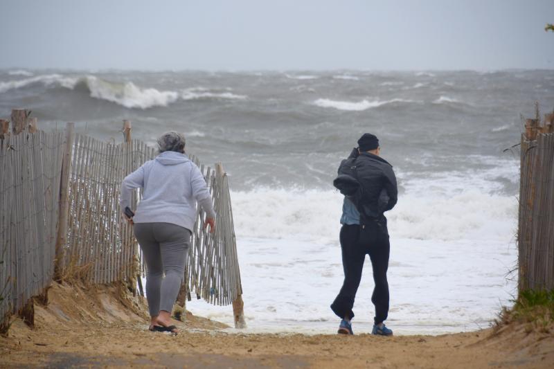
Even with gusty winds up to 50 mph, some people brave the elements to get a closer look at the ocean in Rehoboth Beach. Even before high tide, waves were rolling up the protective dune line. RON MACARTHUR PHOTO
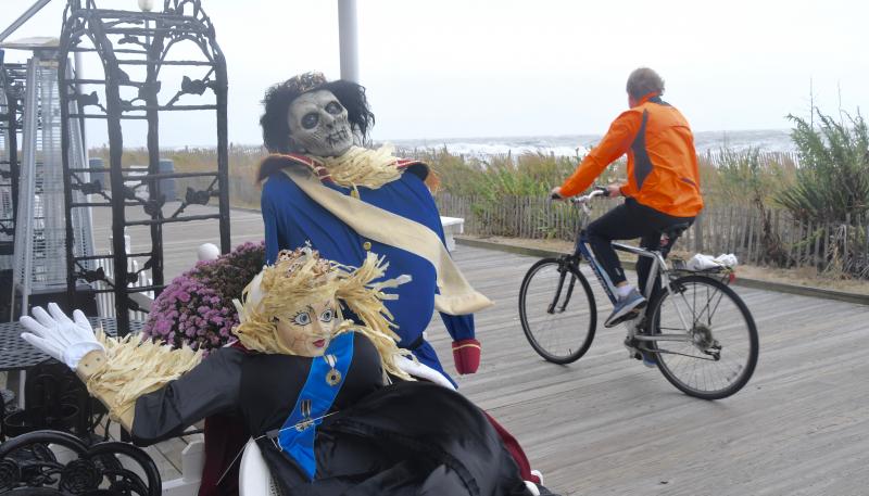
Halloween-dressed mannequins at Boardwalk Plaza keep an eye out during the storm. RON MACARTHUR PHOTO
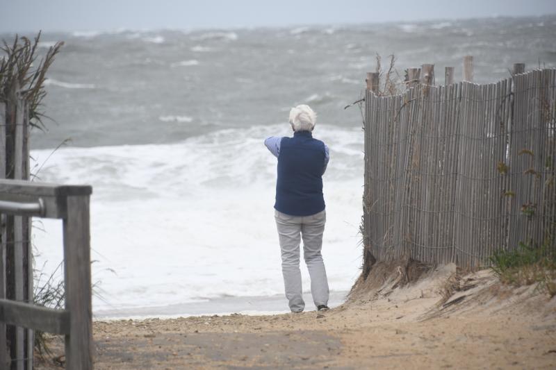
A Rehoboth Beach visitor braves the wind and blowing sand to take photos of an angry ocean. RON MACARTHUR PHOTO
It’s what the dunes along Rehoboth Beach were built for. Heavy ocean surf is pounding the beach up to the dunes. RON MACARTHUR PHOTO
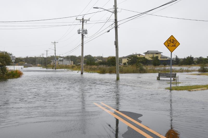
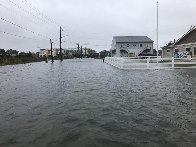
American Legion Road in Lewes is under water as of 2:30 p.m. NICK ROTH PHOTO
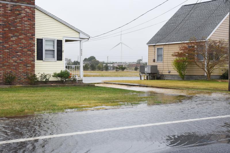
The UD wind turbine can be seen off in the distance as flooding creeps closer to these Cedar Street homes in Lewes. NICK ROTH PHOTO
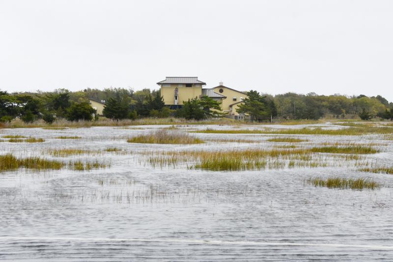
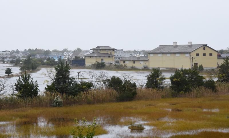
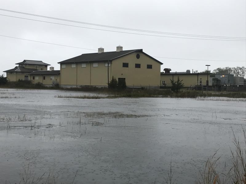
The marsh adjacent to the Lewes wastewater treatment plant is inundated. NICK ROTH PHOTO
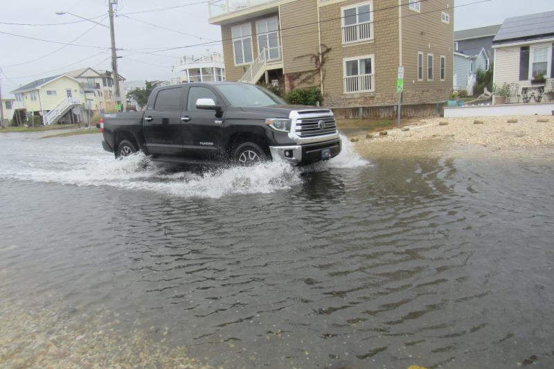
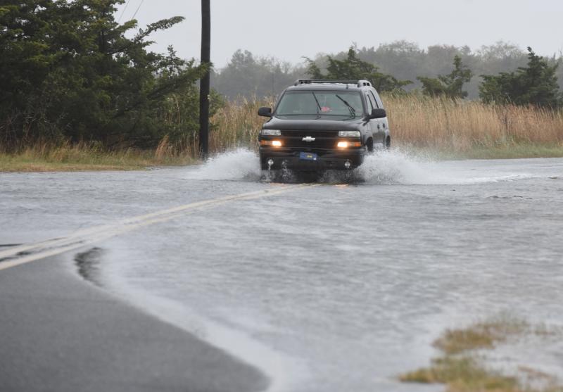
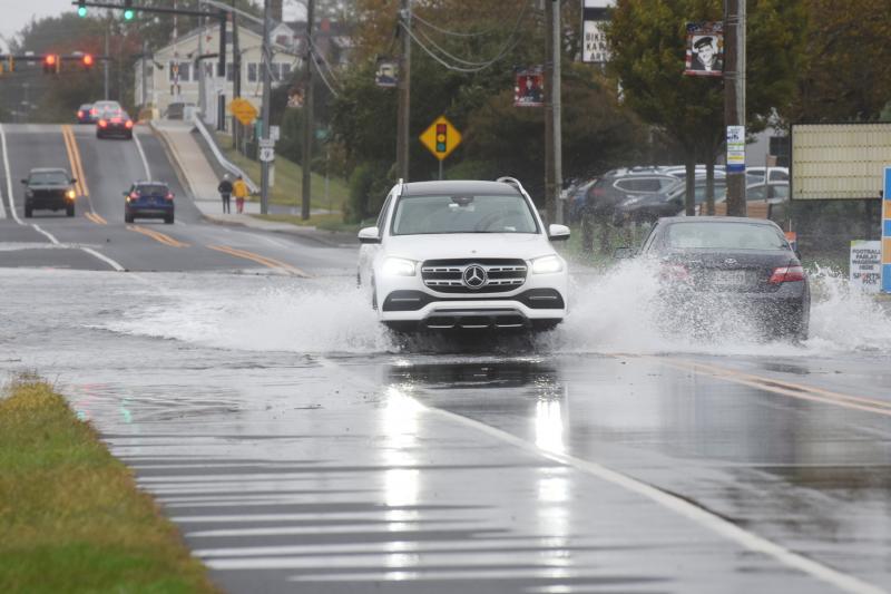
Slow and steady through the flood waters on Savannah Road. NICK ROTH PHOTO
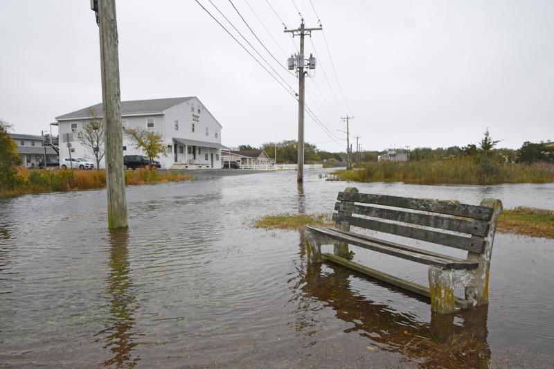
Not the best day to take a rest on this bench in Lewes. NICK ROTH PHOTO
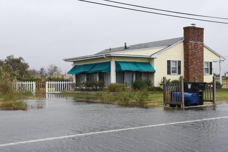
Water begins to surround this Cedar Street home. NICK ROTH PHOTO
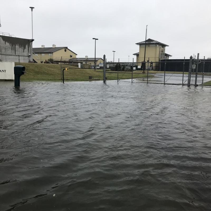
Flood waters rise around the Lewes wastewater treatment plant. NICK ROTH PHOTO
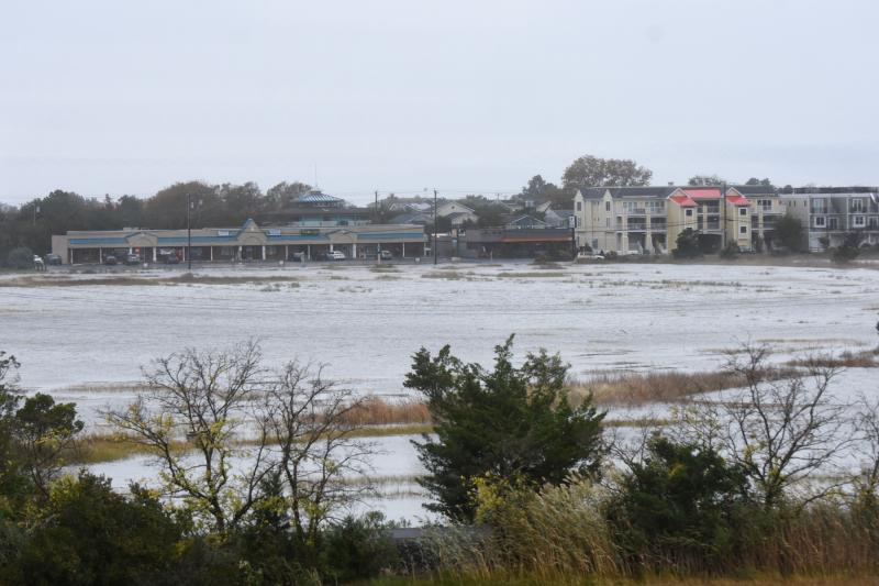
From the Freeman Bridge it appears water is close to the Daily Market shopping center on Savannah Road. NICK ROTH PHOTO
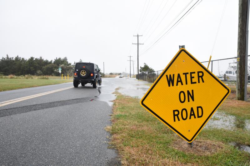
A warning just before deep water on Pilottown Road near the UD campus. NICK ROTH PHOTO
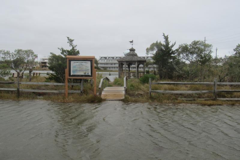
The Lewes-Rehoboth Canal is very high with water heading toward the back side of Lewes Beach homes. NICK ROTH PHOTO
A brave soul wades through the flood waters on Pilottown Road. NICK ROTH PHOTO
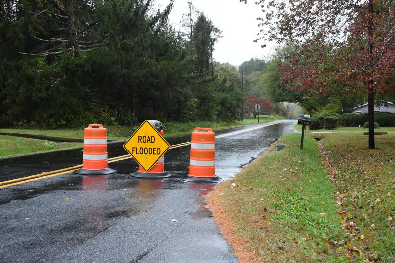
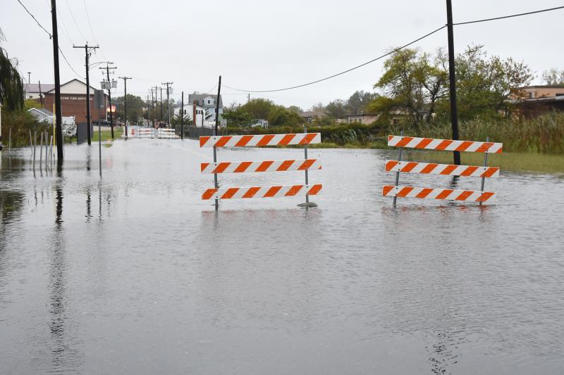
These barriers are designed to stop people from driving down Front Street in Milton. Unfortunately, most people drive around them. NICK ROTH PHOTO
As usual, Magnolia Street is flooded. NICK ROTH PHOTO
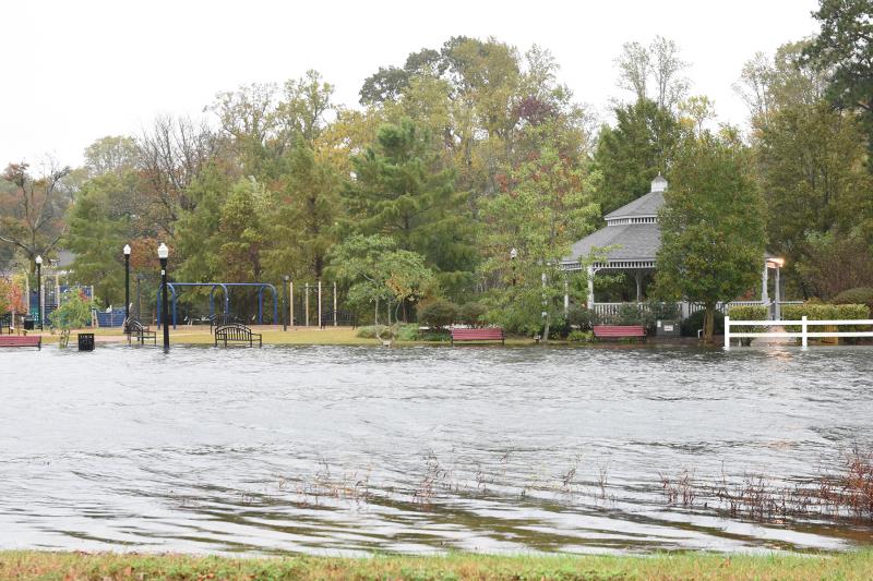
The Broadkill River is so high that it’s creeping into Milton’s Memorial Park. NICK ROTH PHOTO
The blockade on Front Street in Milton may soon float away. NICK ROTH PHOTO
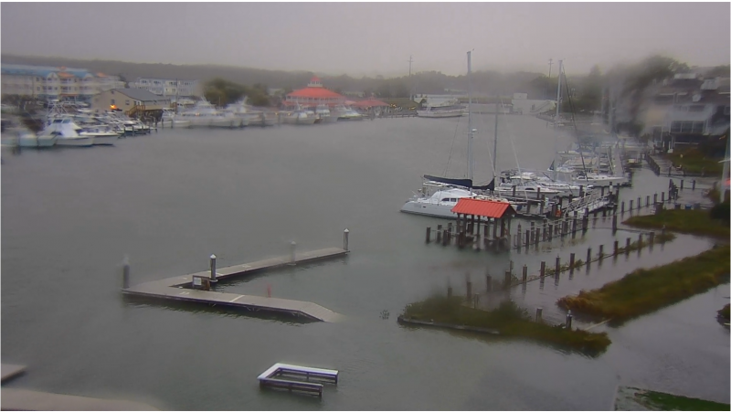
Lewes-Rehoboth Canal in Lewes as seen from the mast of the Lightship Overfalls. SOURCE: LIGHTSHIP OVERFALLS WEBCAM
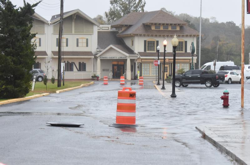
Cars must carefully navigate Savannah Road near the Daily Market. NICK ROTH PHOTO
Rehoboth Bay has overtaken Read Avenue in Dewey Beach. SUBMITTED PHOTO
Rising water nears the front door of this McKinley Street home in Dewey Beach. SUBMITTED PHOTO
A view toward Coastal Highway from Read Avenue. SUBMITTED PHOTO
Streets are flooded from McKinley through Read streets in Dewey. SUBMITTED PHOTO
Water surrounds the Lewes wastewater treatment plant. SUBMITTED PHOTO
It’s difficult to get to the entrance of the Lewes wastewater treatment plant. SUBMITTED PHOTO
It was impossible to get to American Legion Post 17 in Lewes. SUBMITTED PHOTO
Clean up begins in Dewey the morning of Oct. 30. SUBMITTED PHOTO
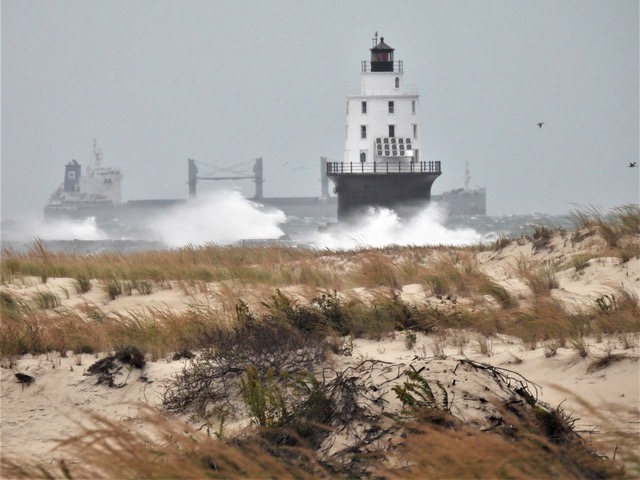
The Harbor of Refuge Light stands tall through the storm. SUBMITTED PHOTO
The Oct. 29 storm pounded the dune on Lewes Beach. RON MACARTHUR PHOTO
The storm took its toll on Lewes Beach. RON MACARTHUR PHOTO
As usual, the beach and large dune in Broadkill kept homes protected. NICK ROTH PHOTO
The dune ledge stands about 10 feet high at Broadkill Beach. NICK ROTH PHOTO
The water level on Read Avenue in Dewey continues to rise Friday afternoon. SUBMITTED PHOTO
Ivy in Dewey Beach is surrounded by flood water the afternoon of Oct. 29 . SUBMITTED PHOTO
There is not much activity on Rehoboth Beach Boardwalk as all outdoor Sea Witch Festival activities are cancelled Oct. 29 due to terrible weather conditions. RON MACARTHUR PHOTO
Waves up to 10 feet churn up the Atlantic Ocean along the shores of Rehoboth Beach. RON MACARTHUR PHOTO
Lewes Beach and Roosevelt Inlet are hit hard by constant waves blown in off Delaware Bay. Significant beach erosion will likely be the aftermath of the Oct. 29 storm. RON MACARTHUR PHOTO
Bay water seeps past the entrance to The Lighthouse in Dewey Beach. The restaurant closed Oct. 29 due to the weather. ELLEN DRISCOLL PHOTO
The entrance to The Lighthouse in Dewey is underwater. ELLEN DRISCOLL PHOTO
Water rises around the Rusty Rudder in Dewey Beach. ELLEN DRISCOLL PHOTO
Even with gusty winds up to 50 mph, some people brave the elements to get a closer look at the ocean in Rehoboth Beach. Even before high tide, waves were rolling up the protective dune line. RON MACARTHUR PHOTO
Halloween-dressed mannequins at Boardwalk Plaza keep an eye out during the storm. RON MACARTHUR PHOTO
A Rehoboth Beach visitor braves the wind and blowing sand to take photos of an angry ocean. RON MACARTHUR PHOTO
It’s what the dunes along Rehoboth Beach were built for. Heavy ocean surf is pounding the beach up to the dunes. RON MACARTHUR PHOTO
American Legion Road in Lewes is under water as of 2:30 p.m. NICK ROTH PHOTO
The UD wind turbine can be seen off in the distance as flooding creeps closer to these Cedar Street homes in Lewes. NICK ROTH PHOTO
The marsh adjacent to the Lewes wastewater treatment plant is inundated. NICK ROTH PHOTO
Slow and steady through the flood waters on Savannah Road. NICK ROTH PHOTO
Not the best day to take a rest on this bench in Lewes. NICK ROTH PHOTO
Water begins to surround this Cedar Street home. NICK ROTH PHOTO
Flood waters rise around the Lewes wastewater treatment plant. NICK ROTH PHOTO
From the Freeman Bridge it appears water is close to the Daily Market shopping center on Savannah Road. NICK ROTH PHOTO
A warning just before deep water on Pilottown Road near the UD campus. NICK ROTH PHOTO
The Lewes-Rehoboth Canal is very high with water heading toward the back side of Lewes Beach homes. NICK ROTH PHOTO
A brave soul wades through the flood waters on Pilottown Road. NICK ROTH PHOTO
These barriers are designed to stop people from driving down Front Street in Milton. Unfortunately, most people drive around them. NICK ROTH PHOTO
As usual, Magnolia Street is flooded. NICK ROTH PHOTO
The Broadkill River is so high that it’s creeping into Milton’s Memorial Park. NICK ROTH PHOTO
The blockade on Front Street in Milton may soon float away. NICK ROTH PHOTO
Lewes-Rehoboth Canal in Lewes as seen from the mast of the Lightship Overfalls. SOURCE: LIGHTSHIP OVERFALLS WEBCAM
Cars must carefully navigate Savannah Road near the Daily Market. NICK ROTH PHOTO
Rehoboth Bay has overtaken Read Avenue in Dewey Beach. SUBMITTED PHOTO
Rising water nears the front door of this McKinley Street home in Dewey Beach. SUBMITTED PHOTO
A view toward Coastal Highway from Read Avenue. SUBMITTED PHOTO
Streets are flooded from McKinley through Read streets in Dewey. SUBMITTED PHOTO
Water surrounds the Lewes wastewater treatment plant. SUBMITTED PHOTO
It’s difficult to get to the entrance of the Lewes wastewater treatment plant. SUBMITTED PHOTO
It was impossible to get to American Legion Post 17 in Lewes. SUBMITTED PHOTO
Clean up begins in Dewey the morning of Oct. 30. SUBMITTED PHOTO
The Harbor of Refuge Light stands tall through the storm. SUBMITTED PHOTOWaters rose and winds whipped through the coastal towns of Delaware Oct. 29 as a strong storm system swept into the Cape Region.
Dewey Beach Town Manager Bill Zolper said town officials were constantly monitoring the storm and in communication with state and county emergency agencies throughout the day.
The police department monitored the town for any extensive flooding and downed wires, Zolper said. Verizon wires forced the town to close Read Avenue oceanside, but Verizon responded and had the problem fixed within a couple hours, Zolper said.
Dewey’s maintenance team continually checked the town’s pumping station on Bayard Avenue, and evaluated the beach and dune line.
“The tide came in extremely quick after 4:30 p.m. and flooded Dewey for three hours,” Zolper said. “Water came over the barrier at the pump station. Bellevue and Bayard [streets] flooded. The pumps couldn’t keep up with the tide.”
The stretch of Route 1 between Dewey Beach and Bethany Beach closed about 5:30 p.m., Oct. 29, and reopened about 6:30 a.m., Oct. 30.
At about 8:30 a.m., Oct. 30, Zolper said flooded streets were slowly draining, with Read Avenue hit the worst. Town crews were back at 3 a.m., Oct. 30, working on the pumps at Bayard Avenue and clearing storm drains around town, Zolper said.
Flooding and damage were not limited to Dewey, as the Cape Region’s other beaches were also pounded by the storm. Bay water carved into the dunes in Lewes and Broadkill Beach, leaving cliffs as tall as 10 feet behind. The beach near Indian River Inlet bridge was also affected.
“Friday's storm did have a significant impact on Lewes, further eroding the beach,” said Lewes Mayor Ted Becker. “In addition, although the actual storm event lasted only a few hours here in Lewes – roughly from 4 to 7 p.m. – the flooding of low-lying areas was significant.”
DNREC’s Shoreline and Waterway Management section is assessing areas that were impacted by erosion and assigning priorities for repair and restoration, said Jesse Hayden, acting administrator and project engineer.
“The Delaware Seashore State Park beach north of Indian River Inlet experienced dune erosion in the storm that was mitigated by ongoing sand management by DNREC that will continue throughout the winter,” Hayden said. “Along the Delaware Bay beaches, DNREC will evaluate opportunities to restore the main pedestrian dune crossing at the end of Route 16 in Broadkill Beach, while monitoring the conditions there throughout the winter so as to plan maintenance on other less-trafficked dune crossovers.”
In Lewes, he said, they will similarly evaluate opportunities to restore some pedestrian dune crossings, though it is unlikely they will have the ability to address all crossovers immediately. “We will also continue to evaluate the location of dune fencing relative to the eroding dune, adjusting its location if necessary,” he said.
Hayden said Delaware is in the early days of the 2021-22 winter storm season that could bring additional storms and beach erosion.
“Our goal goal right now is to comprehensively assess the erosion damages across all of the beach communities to prioritize our response,” he said. “We are in the planning stage of a project to potentially haul sand into Pickering Beach, Kitts Hummock, Bowers, Slaughter Beach and Delaware Seashore State Park to nourish portions of those beaches and the dunes most susceptible to chronic erosion. We are currently evaluating opportunities to adjust the plans for that project in response to the storm erosion that has occurred since the most recent storm.”
The Oct. 29 storm pounded the dune on Lewes Beach. RON MACARTHUR PHOTO
The storm took its toll on Lewes Beach. RON MACARTHUR PHOTO
As usual, the beach and large dune in Broadkill kept homes protected. NICK ROTH PHOTO
The dune ledge stands about 10 feet high at Broadkill Beach. NICK ROTH PHOTO
The water level on Read Avenue in Dewey continues to rise Friday afternoon. SUBMITTED PHOTO
Ivy in Dewey Beach is surrounded by flood water the afternoon of Oct. 29 . SUBMITTED PHOTO
There is not much activity on Rehoboth Beach Boardwalk as all outdoor Sea Witch Festival activities are cancelled Oct. 29 due to terrible weather conditions. RON MACARTHUR PHOTO
Waves up to 10 feet churn up the Atlantic Ocean along the shores of Rehoboth Beach. RON MACARTHUR PHOTO
Lewes Beach and Roosevelt Inlet are hit hard by constant waves blown in off Delaware Bay. Significant beach erosion will likely be the aftermath of the Oct. 29 storm. RON MACARTHUR PHOTO
Bay water seeps past the entrance to The Lighthouse in Dewey Beach. The restaurant closed Oct. 29 due to the weather. ELLEN DRISCOLL PHOTO
The entrance to The Lighthouse in Dewey is underwater. ELLEN DRISCOLL PHOTO
Water rises around the Rusty Rudder in Dewey Beach. ELLEN DRISCOLL PHOTO
Even with gusty winds up to 50 mph, some people brave the elements to get a closer look at the ocean in Rehoboth Beach. Even before high tide, waves were rolling up the protective dune line. RON MACARTHUR PHOTO
Halloween-dressed mannequins at Boardwalk Plaza keep an eye out during the storm. RON MACARTHUR PHOTO
A Rehoboth Beach visitor braves the wind and blowing sand to take photos of an angry ocean. RON MACARTHUR PHOTO
It’s what the dunes along Rehoboth Beach were built for. Heavy ocean surf is pounding the beach up to the dunes. RON MACARTHUR PHOTO
American Legion Road in Lewes is under water as of 2:30 p.m. NICK ROTH PHOTO
The UD wind turbine can be seen off in the distance as flooding creeps closer to these Cedar Street homes in Lewes. NICK ROTH PHOTO
The marsh adjacent to the Lewes wastewater treatment plant is inundated. NICK ROTH PHOTO
Slow and steady through the flood waters on Savannah Road. NICK ROTH PHOTO
Not the best day to take a rest on this bench in Lewes. NICK ROTH PHOTO
Water begins to surround this Cedar Street home. NICK ROTH PHOTO
Flood waters rise around the Lewes wastewater treatment plant. NICK ROTH PHOTO
From the Freeman Bridge it appears water is close to the Daily Market shopping center on Savannah Road. NICK ROTH PHOTO
A warning just before deep water on Pilottown Road near the UD campus. NICK ROTH PHOTO
The Lewes-Rehoboth Canal is very high with water heading toward the back side of Lewes Beach homes. NICK ROTH PHOTO
A brave soul wades through the flood waters on Pilottown Road. NICK ROTH PHOTO
These barriers are designed to stop people from driving down Front Street in Milton. Unfortunately, most people drive around them. NICK ROTH PHOTO
As usual, Magnolia Street is flooded. NICK ROTH PHOTO
The Broadkill River is so high that it’s creeping into Milton’s Memorial Park. NICK ROTH PHOTO
The blockade on Front Street in Milton may soon float away. NICK ROTH PHOTO
Lewes-Rehoboth Canal in Lewes as seen from the mast of the Lightship Overfalls. SOURCE: LIGHTSHIP OVERFALLS WEBCAM
Cars must carefully navigate Savannah Road near the Daily Market. NICK ROTH PHOTO
Rehoboth Bay has overtaken Read Avenue in Dewey Beach. SUBMITTED PHOTO
Rising water nears the front door of this McKinley Street home in Dewey Beach. SUBMITTED PHOTO
A view toward Coastal Highway from Read Avenue. SUBMITTED PHOTO
Streets are flooded from McKinley through Read streets in Dewey. SUBMITTED PHOTO
Water surrounds the Lewes wastewater treatment plant. SUBMITTED PHOTO
It’s difficult to get to the entrance of the Lewes wastewater treatment plant. SUBMITTED PHOTO
It was impossible to get to American Legion Post 17 in Lewes. SUBMITTED PHOTO
Clean up begins in Dewey the morning of Oct. 30. SUBMITTED PHOTO
The Harbor of Refuge Light stands tall through the storm. SUBMITTED PHOTO