For the second year in a row, state legislators have cut funding for a program that permanently protects open space in Delaware.
The lack of direct state funding means Delaware's Open Space Program will miss out on millions of dollars in federal and private grants, said Ron Vickers, manager of the Department of Natural Resources and Environmental Control Division of Parks and Recreation Land Preservation Office.
“We're losing out on about $6 million to $8 million in federal funds,” Vickers said. “We've also been successful working with private conservation groups, but they want to see where the state's share is. In some cases, there are 2-1 or 3-1 matches, or even higher. We're losing some significant funding sources there.”
Vickers said the Open Space Program – which historically secured $9 million annually – has seen its budget reduced by 78 percent in the last four fiscal years.
“I'd dare say there are very few long-standing state programs that have had that kind of reduction,” Vickers said. With no funding allocated in fiscal year 2016 or 2017, the program now has about $2 million left in unallocated funds, which may pay for some land acquisition, but will not allow for any long-term project planning.
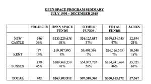
Since the Land Protection Act was signed in 1990, more than $350 million in open space funds and matching grants have permanently protected about 58,000 acres of open space – with more than half in Sussex County.
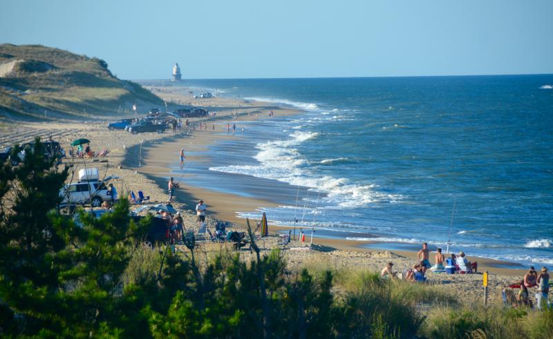
Without the program, Cape Henlopen State Park in Lewes would be about half the size it is today, and Delaware Seashore State Park in Rehoboth Beach would be 1,000 acres smaller, records show.
Statewide, the voluntary program has expanded Fish & Wildlife management areas by 38 percent, state forests by 50 percent and state parks by 60 percent, Vickers said.
People may not realize these areas also are large economic drivers, Vickers said. A 2011 census report shows 344,000 people utilized open space in Delaware for fishing, hunting and wildlife watching, and spent about $325 million on direct and related activities, he said, and an outdoor recreation report from 2012 shows outdoor recreation contributes $4 billion in consumer spending in the region and $304 million in state and local tax revenue.
“The really frustrating part is that there's a demand from Delawareans for bike trails and just preserving open space,” said John Schroeder, chair of the Open Space Council, the public body that oversees the program. “There's a demand for us to acquire open space, and we just don't have the funding.”
Since its inception, the state's Open Space Program always has been voluntary. Interested landowners can approach members of the Open Space Council or participating state agencies to determine whether their land is eligible for preservation through a direct sale or conservation easement. The Open Space Council also identifies lands in need of preservation – oftentimes extending the borders of already protected land – and approach a landowner to discuss preservation options.
In the original Land Protection Act, State Resources Area maps highlighted areas environmental officials identified as important for wildlife and recreation, and mandated that counties consider those maps in land-use planning decisions. Those maps, however, have been a contentious topic for more than decade, facing two lawsuits related to how they were developed and used.
A lawsuit brought by three landowners in 2006 challenged a revision of the maps, arguing that identifying a piece of property as a State Resource Area could devalue it and that the maps could be used to restrict how private property could be used. That lawsuit was resolved in 2009 with the Delaware Court of Chancery declaring the maps null and void. However, that decision was not based on property rights; instead, the court found that DNREC developed the criteria and the maps when, by law, it was the Open Space Council that should have developed the standards and criteria for the maps, not DNREC, Vickers said.
“So from there, DNREC moved forward in time and started to look from a different perspective,” Vickers said. Issues with an acquisition in New Castle County in 2014 sparked another lawsuit from the Delaware Audubon Society, which argued the council and DNREC were not following standards and criteria when purchasing land, and were failing to follow the mandate to update resource area maps.
That lawsuit was settled in 2015, with an agreement that directed the Open Space Council and DNREC to move forward with revising the standards and criteria, and updating the State Resource Area maps by May 31.
But a recent revision to the Land Protection Act, which has passed the General Assembly and now awaits Gov. Jack Markell's signature, has eliminated those maps from the program.
When the act came before the Joint Sunset Committee for periodic review last year, developers and landowners fought against public maps showing lands the state identified for protection. In a new bill, the historically used State Resource Area maps will be replaced with documents that show what has already been preserved. By nixing State Resource Area maps, the bill also removes the requirement for counties to consider future open space acquisitions in land-use planning or comprehensive plan updates.
The primary sponsor of the bill, Rep. Gerald L. Brady, D-Wilmington West, said the General Assembly's decision to nix funding for open space acquisition came just hours after his bill – Substitute 1 for House Bill 262 – passed the Senate.
“Now, you're talking about government – here's where it gets really sticky – it sounds all good and gushy that we are saving and protecting open space for our sons and daughters and generations here to come,” Brady said. “Tell that to a landowner.”
Brady said the desire of some constituents and lobbyists to keep the maps confidential sparked the decision to eliminate them altogether. The updated law also exempts any data collected on the properties in negotiation for preservation from the Freedom of Information Act.
Vickers said even without the maps the program will still function, but the counties will no longer be required to consider the Land Protection Act in local land-use planning decisions.
“If a county asks for specific data or information, they can do that if they choose,” Vickers said. “It's very important that at this point in time, with limited resources for agencies across the board – state, county, local and private – to come together and decide what is important. What do we want Sussex County to look like 10 or 15 years down the road? And how do we do it?”
David Carter, conservation chair of the Delaware Audubon Society, said Brady's bill is like a “get-out-of-jail-free” card for DNREC.
“They were required to go through a public process and remap. They changed the legislation to do away with that,” he said. “The bigger issue is we now have a process open to the whims of DNREC and politics.”
Carter said state officials need to rethink how the Open Space Program works and how to work with private landowners to protect land from development.
“They need to really rethink what's the unfulfilled agenda, what haven't we accomplished that's really important, and what’s the most cost-effective way to do it?” he said. “We're not going to protect every acre. We have to find where we'll get the best bang for our buck and concentrate on those. But if this program doesn't get some visibility and rebuild some public enthusiasm, its whole purpose is going to go away.”


