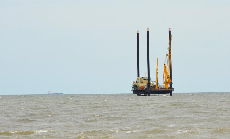
Ørsted vessel moves in for near-shore survey work
A large survey vessel conducting work for Ørsted has set up shop just off the coast of Delaware, near Towers Beach in Delaware Seashore State Park.
The Cape Gazette reported in early March the Danish-based energy company would soon resume near-shore geophysical surveying for its Skipjack 1 and Skipjack 2 projects.
The Maryland Public Service Commission has twice awarded Offshore Renewable Energy Credits to Ørsted for wind farms in federal waters that stretch from Rehoboth Beach to Fenwick Island – Skipjack Wind 1, a 120-megawatt project in 2017; and Skipjack Wind 2, an 846-megawatt project, in late 2021. The closest portion is roughly 16 miles from shore.
According to the April 21 mariner’s briefing provided by Ørsted, the company is conducting geophysical surveying in three locations. Area 1 encompasses the mouth of the Delaware River, around The Point in Cape Henlopen State Park and out into the ocean. Area 2 is in the ocean, but near shore, and stretches from Rehoboth Beach south to the Indian River Inlet bridge. Area 3 comprises the Indian River Bay, west to the Indian River power plant.
In addition to the lift vessel, there are two more vessels in the immediate area conducting geophysical surveying – the 53-foot Time and Tide in survey areas one and two, and the 22-foot William M. Time in area three.
Brady Walker, Ørsted Mid-Atlantic market manager, confirmed the lift vessel operating off the coast is the RAM-XC.
The vessel continues to perform survey work as part of Ørsted's analysis of potential cable routes for Skipjack Wind, said Walker in an April 22 email. Survey work has occurred in Indian River Bay and will occur off the coast of 3 R's beach as well, he said.
Ørsted will include its survey findings in the Construction and Operations Permit it submits to the U.S. Bureau of Ocean Energy Management later this year, said Walker. The bureau will make the final decision on the best location after it holds a public comment period and conducts a comprehensive environmental review, he said.
“No decisions have been made regarding the best cable route or landfall location,” said Walker.
In a previous story, Walker said he expected the near-shore survey work to be completed by Memorial Day. If it wasn’t completed, he said, the company will resume survey work in September.
Chris Flood has been working for the Cape Gazette since early 2014. He currently covers Rehoboth Beach and Henlopen Acres, but has also covered Dewey Beach and the state government. He covers environmental stories, business stories and random stories on subjects he finds interesting, and he also writes a column called Choppin’ Wood that runs every other week. He’s a graduate of the University of Maine and the Landing School of Boat Building & Design.


