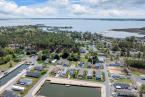
There are at least three ways that sea-level rise can have a direct negative impact on Lewes and Rehoboth.
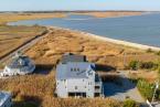
The first is flood damage risk. On Oct. 14, I did an internet search on the keyword string "Lewes Delaware riskfactor.com." It gave me this quote: "...1,200 properties [two-thirds of all in Lewes] ... greater than 26% chance of being severely affected by flooding over the next 30 years." I did the same search for Rehoboth and it told me that 18% of all properties get the same chance outcome. The firststreet.org website also does climate change risk analysis, and it also has bad climate change impact news for, specifically, Lewes and Rehoboth.
Second, local beach replenishment comes up regularly in Gazette articles because beach erosion regularly depletes Lewes and Rehoboth beaches of their sand. Replenishment costs about $15 per cubic yard and up. Replenishment for Lewes and Rehoboth involves million-cubic-yard quantities and thus significant budget resources. Future replenishment costs will be going up quite a bit as sea-level rises will lead to more storm, wave and tide action.
Third, as the sea level rises, more of the local beach area will end up underwater. There will also be numerous secondary effects such as increases in insurance premiums.
Now, here is the new bad news. Recently obtained data is showing that in recent years, the rates of sea-level rise have increased to three times higher than all prior decades. This implies two things: First, that all the outcome forecasts mentioned are likely to come sooner and the risk factors will be larger. Second, we need to worry about even further increases in rates of sea-level rise in the future. As everyone knows, an ice cube will melt faster in a warmer room, so we should also expect that sea level will rise faster as global temperatures continue to go up. And this year, 2023, we had record-high temperatures, per statements from numerous agencies.
The 40-page City of Lewes 2021 report titled West Cedar Avenue Flood Mitigation Planning Study has projections based on the Lewes NOAA tide gauge data, from before 2021, at the ferry terminal. Actual Lewes sea-level rise data from the tide gauge can be accessed at psmsl.org, and despite the scatter in the graph, it also shows a sea-level rise rate increase in the last few years. There are a number of other relevant good and detailed Delaware coastal studies, but they all need to be revisited and revised to include that negative impacts will come sooner.
-

A letter to the editor expresses a reader's opinion and, as such, is not reflective of the editorial opinions of this newspaper.
To submit a letter to the editor for publishing, send an email to viewpoints@capegazette.com. All letters are considered at the discretion of the newsroom and published as space allows. Due to the large volume of submissions, we cannot acknowledge receipt of each submission. Letters must include a phone number and address for verification. Keep letters to 400 words or fewer. We reserve the right to edit for content or length. Letters should be responsive to issues addressed in the Cape Gazette rather than content from other publications or media. Letters should focus on local issues, not national topics or personalities. Only one letter per author will be published every 30 days regarding a particular topic. Authors may submit a second letter within that time period if it pertains to a different issue. Letters may not be critical of personalities or specific businesses. Criticism of public figures is permissible. Endorsement letters for political candidates are no longer accepted. Letters must be the author’s original work, and may not be generated by artificial intelligence tools. Templates, form letters and letters containing language similar to other submissions will not be published.