Rehoboth Beach’s street layout as of 1950
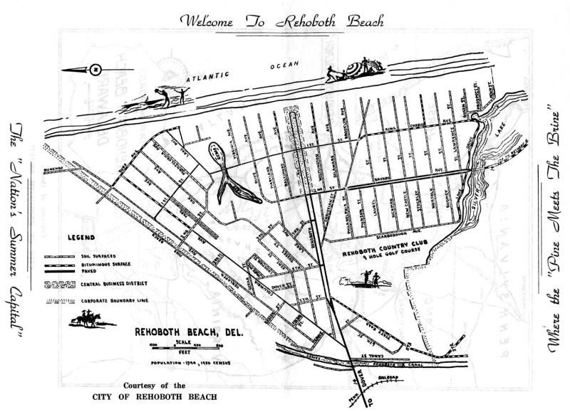
Rehoboth Beach’s streets fan out left and right from where Rehoboth Avenue crosses Lewes-Rehoboth Canal at the drawbridge. This City of Rehoboth Beach map from 1950 shows all of the streets with very few changes having been effected in the 70 years since.
The legend on the left side of the map shows how few streets in Rehoboth Beach were paved as of 1950, the greatest majority of them soil surfaces. The map also shows the Baltimore and Wilmington avenues on either side of Rehoboth Avenue where there is a lot of current attention for rejuvenation of those two secondary commercial areas.
On the left side of Rehoboth Avenue are Baltimore and Maryland avenues while on the right side are Wilmington and Delaware avenues. Those street name choices are a nod to the two metropolitan areas where early marketers in Rehoboth focused their attention for drawing buyers for the resort.