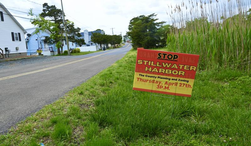
Residents voice concerns with Stillwater Harbor
Editor’s note: This is the first of two stories about Stillwater Harbor. The second part will discuss emergency access and residents’ concerns.
The public record remains open on the Stillwater Harbor subdivision application. Following a nearly five-hour public hearing during its April 27 meeting, the Sussex County Planning & Zoning Commission voted to defer a decision until after additional information is submitted.
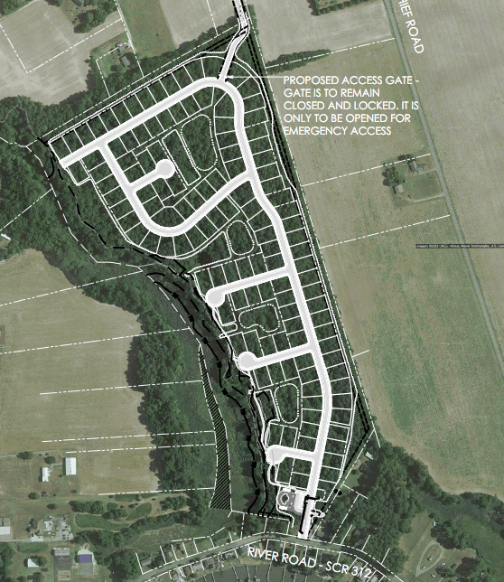
The plan for the cluster subdivision on River Road near Oak Orchard includes 123 single-family home lots on a 57-acre parcel.
While many issues were discussed during the hearing, some topics dominated, including flooding and increased traffic on River Road, and a proposed gated emergency access road.
The record will remain open for written comment until 4:30 p.m., Friday, May 5. On the advice of assistant county attorney Vince Robertson, the commission is seeking additional information on an easement for the proposed emergency access road and a review by the county engineer of the proposed wetland buffers on the site plan.
Commissioners also expressed concern about the possibility of Native American burial grounds on the property, whether there is enough space to widen the area for the entrance to the subdivision and how residents will get in and out of the community during flooding periods on River Road.
DNA in the land
Although there may be several outstanding questions on the application, there is no doubt area residents oppose the project.
The public record includes 110 letters in opposition and three petitions with 1,646 signatures opposing the subdivision. Several residents who testified during the hearing made impassioned pleas to the commission to deny the application.
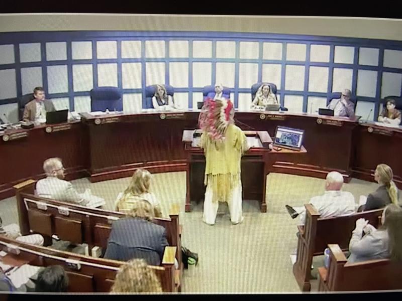
Former Nanticoke Indian Chief Charles C. Clark IV (Little Owl) appeared in full Native American regalia and put on a war bonnet headdress because, he said, he was going to war to stop the project.
“My family has lived here an uncounted number of years,” he said. “Our DNA is in the land, and the land is in our DNA. On behalf of the Nanticoke people, myself, Mother Earth and all of the animals, none of us need another development. Sussex County is being destroyed by short-sightedness. You don't have to pave everything that's green.”
Stillwater Harbor plans
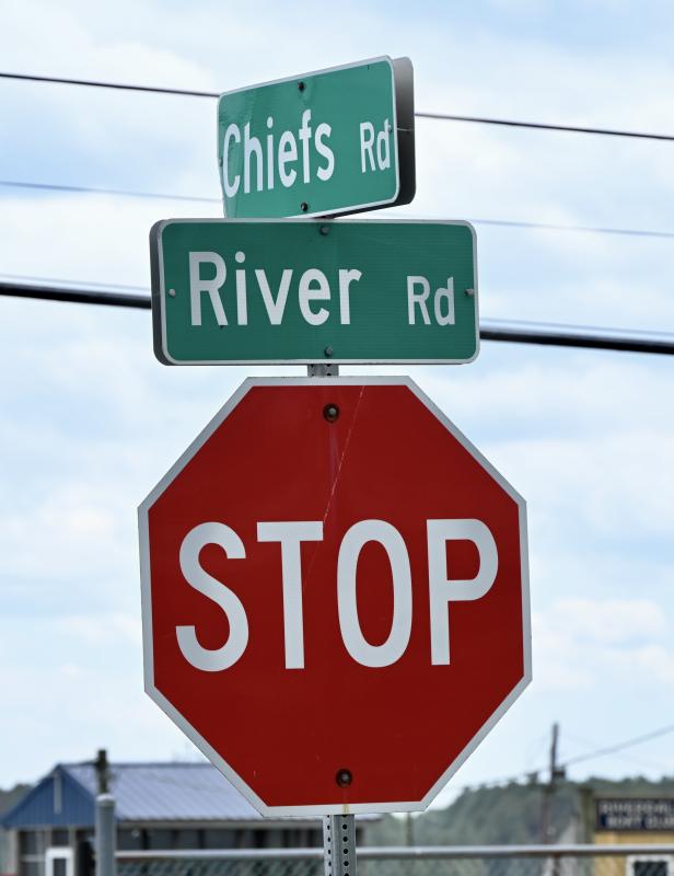
Attorney Mackenzie Peet, representing developer Stillwater Harbor LLC, outlined plans for the subdivision, which is three-tenths of a mile from the Chiefs Road intersection. The parcel is zoned GR, general residential, and MR, medium-density residential.
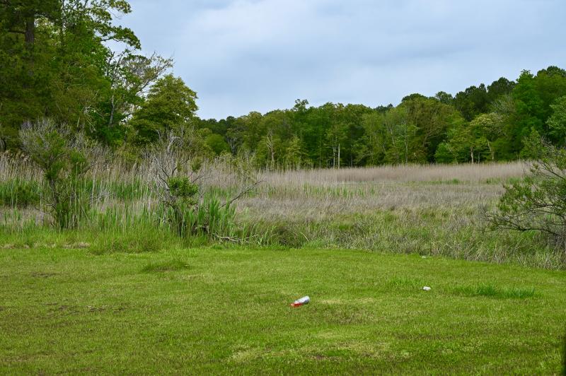
The plan includes a 100-foot buffer along two acres of tidal wetlands and a 30-foot buffer along three acres of nontidal wetlands along the western edge of the property. There would also be a 30-foot buffer along farmland adjacent to the property and a 20-foot buffer along residential areas.
Peet said all lots would be clustered toward the center of the property to preserve the wetland areas.
The property contains 54 acres of woods. In the plan, 42 acres of woods would be removed during construction with 12 acres of woods being preserved. Ten acres of existing forest would be preserved, with nearly two acres of restored woodlands.
The plan includes 26 acres of interconnected open space, or 47% of the parcel's total acreage.
Amenities would include a pool, bathhouse, sidewalks on both sides of interior streets and a wood-chip trail to a wooded area on the western edge of the parcel.
The plan includes an emergency access road for ambulances and fire apparatus from the rear of the property along a 50-foot easement to Jack Draine Lane. The gated access would only be used in the event of flooding on River Road. The unimproved road is used by several residents.
Peet reminded the commission that housing projects such as Stillwater Harbor are permitted uses under the county's comprehensive land-use plan if all regulations and ordinances are adhered to.
“If the subdivision is compliant, it should be approved, and the commission can place reasonable conditions on approval per the ordinance,” she said.
Drainage and flooding
The development team said while flooding would still occur on River Road, Stillwater Harbor's proposed stormwater management system would lessen the impact in the immediate area.
“Flooding is a big concern. In Oak Orchard, it's a regional issue,” said consultant Greg Sauter, vice president of Geo-Technology Associates in Georgetown.
He said the stormwater management plan includes four stormwater retention ponds that will help move water runoff to the Chiefs Road area.
He said on the west side of the property, there would be no adverse impact from runoff caused by the development.
“Flooding will continue, but this plan will lessen the impact,” he said.
Sauter said there are ways to minimize flooding in the area if residents work with the Delaware Department of Natural Resources and Environmental Control and the Delaware Department of Transportation. “We can never get rid of flooding; we have to mitigate it the best we can,” he said. “With the Stillwater Harbor plans and DNREC solutions, the quality of life can be improved for existing residents and new residents.”
“Flooding seems to be getting worse,” said Commission Chair Bob Wheatley. “The residents are the experts on what is happening there.”
Jim Eriksen, engineer with Solutions IPEM in Georgetown, said a large section of Oak Orchard is within a 100-year floodplain, but the majority of the proposed Stillwater Harbor property is not. “It has a higher elevation than the rest of the area,” he said.
Discharge sites from the property will include channel crossings under River Road to Indian River Bay. He said DNREC and DelDOT officials are aware of the flooding issues and have issued a report on possible remediation projects, including raising the height of River Road, improved channel discharge and a rebuilt bulkhead along the bay. He said the projects are subject to the availability of funding and will need cooperation from property owners and HOAs.
Eriksen said flooding is caused by upstream water runoff and storm surge from the bay at channel crossings along River Road.
He said research shows that sections of River Road, especially at the River Road-Chiefs Road intersection, flood four to eight times per year.
Eriksen said the property comprises 36% of the drainage area to the area of the intersection. “There will be immediate improvement in drainage in the area,” he said.
Several residents said they doubted that runoff and flooding would reduced because of the community’s proposed stormwater management plan.
Kenneth Clark, who lives at the intersection of Chiefs and River roads, said he is affected by flooding more than anyone else. “Flooding will get worse if Stillwater is built. All the trees cut down will create flooding and impact the natural flow,” he said, adding that development has contributed to increased flooding over the years. “Flooding has gotten worse; I’ve watched it with my own eyes. Additional development is the only change in the area.”
Roads and traffic
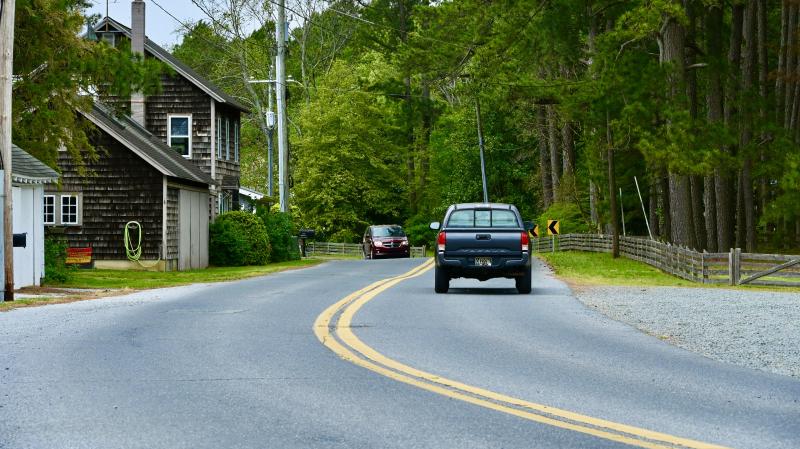
DelDOT would require the developer to improve the parcel's road frontage with 11-foot travel lanes and 5-foot shoulders. The developer would also have to contribute funds to a traffic signal agreement at the Route 24-Gull Point Road intersection and improvements at the Route 24-Mount Joy Road-Oak Orchard Road intersection.
Traffic consultant Betty Tustin said the subdivision would generate 1,258 vehicle trips per day (629 into the subdivision and 629 out). Currently, the average traffic count on River Road is 742 vehicles per day.
Tustin said it's estimated that 59% of the traffic would go east and 41% west on River Road or about one additional vehicle every four minutes on River Road.
Todd Sammons, assistant director of the DelDOT Division of Planning, said the amount of proposed traffic from the development did not meet the threshold for a traffic-impact study. Instead, the developer would be required to contribute $12,580 to an area-wide study fee, which is $10 for each vehicle trip.
Commissioner Bruce Mears asked if any land would be taken from property owners along River Road to make road improvements.
“We don't know what can fit out there until we see the design. Typically, there is enough right of way,” Sammons said.
Eriksen said the current road varies in width from 22 feet to 26 feet. Proposed improvements would increase the width to 32 feet and require a right of way from 42 feet to 46 feet.
Several River Road residents said they would not grant right of way for road improvements.
