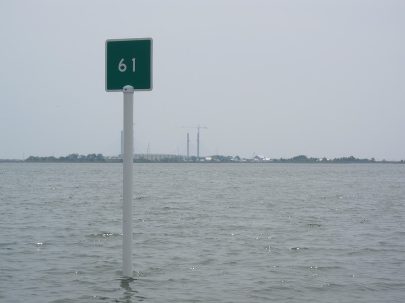
Boaters who think twice about picking their way through Massey's Ditch to get back and forth between Rehoboth and Indian River bays now have a faster and less treacherous alternative.
The Water Use Implementation Committee at the Center for the Inland Bays teamed up earlier this year with the state's Division of Watershed Stewardship to delineate and mark a channel that local boaters have known about for a number of years. From the Rehoboth Bay side, the newly marked channel heads eastward along the north side of Robinson Island before it makes a wide sweeping turn to the south between the west end of Burton Island and the eastern end of Robinson Island.
The new marks start with a green 51 just east of the last Rehoboth Bay marker before boaters enter the Massey's Ditch channel. They end, with red marker 68, just short of the Coast Guard's Indian River channel markers off the southwestern end of Burton Island. At least that's supposed to be the last marker. Chuck Williams, chief of the watershed stewardship division, said since the new marks were sunk in the bottom last February, No. 68 has gone missing. "We're planning on getting that marker back in position by Memorial Day weekend," said Williams.
He said the markers will also be renumbered in accordance with a request from the Coast Guard. "Instead of No. 51, the channel's first marker will become 1B and will go up to the final marker which will be 18B," said Williams. He said he's not sure whether the B stands for Burton Island or Capt. Bill Baker, of bait and tackle fame, who sits on the committee that suggested marking the new route.
In the world of navigation, green channel day markers have square shapes and are designated with odd numbers. Red markers have triangle shapes designated with even numbers. Heading upriver or toward ports, the marker numbers go up and red markers designate the right side of the channel. That's where the familiar nautical phrase "red right returning" comes from. Outbound, the situation, naturally, is reversed.
Williams said watershed stewardship personnel delineated the new channel and a marine group hired by the Center for the Inland Bays drove the poles for the markers into the sandy bottom last February. The watershed division will take over responsibility for the new markers. The route is so new it's not showing up on any charts. In fact, on Nellie's GPS machine, the route showed our vessel go ing across wetlands. Situational awareness trumps those electronic images.
Capt. Aaron Hurd, supervisor of the state's Fish and Wildlife Division, said it's been known for years that "there was a moderately deep channel around the east side of Robinson Island." The channel carries between three and four feet of water in its shallowest stretches, at mean low water. Other stretches, especially between the two islands, has much deeper water - so deep, in fact, that the company that put in the marker poles had to place them unusually far apart at the southern end of the route because that's what it took to find water shallow enough to keep the white PVC poles and marks visible. Williams said the channel is too wide in that southern area. 'We're going to see if we can narrow it down some to make it clearer for boaters."
Williams said the state is also working on a solution for the main reason why many boaters would just as soon avoid the Massey's Ditch route - between Massey's Landing on Long Neck and Robinson Island. "The shoaling is getting worse and worse at Middle Island at the south end of the ditch," said Williams. "We're working on getting that area dredged before the end of this year and also looking at constructing some kind of structure to divert water so the shoaling doesn't build so quickly."
Middle Island is the small island south of the Massey's Landing launching ramp. The state built an artificial heron rookery on the island a number of years ago. When Becky and I passed the island last Saturday and Sunday during a Nellie Lankford reconnaissance trip from Lewes southward through the recently dredged Assawoman Canal, the rookery was loaded with at least 50 egrets and herons staking out nesting territory.
I'm happy to report that we made it through Assawoman Canal, at mid to low tide, without bumping once. We draw a little more than two feet. Nellie rides about six and a half feet above water level and we made it beneath the canal's three bridges with three and four feet of clearance.
We cruised south to Fenwick Island and ate lunch at Matt Haley's Catch 54 Restaurant, waterside, at the Fenwick Cut. I'll be blogging about that and posting more pictures from that whole adventure on the Cape Gazette website over the course of the next week.
One final note: in case you're confused, the state's Division of Watershed Stewardship was known for several decades as the Division of Soil and Water Conservation. Whatever you call the group, they did a nice job dredging the Assawoman Canal and also get high marks - along with the Center for the Inland Bays - for the newly marked passage between Rehoboth and Indian River bays. For the thousands of small and shallow-draft vessels using the magnificent Inland Bays system, these improvements have enhanced the boating experience immeasurably.


