A few centuries back, when round, blue-and-yellow containers of salt weren’t so plentiful on our grocery-store shelves, European settlers in these parts looked to the sea for this valuable spice.
It’s believed that the broad expanse of shallow water just inside the dunes of Cape Henlopen State Park, between Lewes and Rehoboth Beach, known now as Gordons Pond, started out as a manmade impoundment for the gathering of sea salt. Men cut channels across the beach and through the dunes to allow high ocean tides to fill sand-bottomed flats contained within hand-shoveled dikes. After the sun evaporated much of the water, the remaining super-salty liquid would then be bucketed into large cast-iron pots and boiled off over driftwood or pine-bough fires. The process provided a steady supply of salt to preserve meat and fish for the settlers.
One of those historic pots sits in front of Rehoboth Art League’s Homestead Mansion in Henlopen Acres, the 17th century home of generations of the Marsh family who mined their salt in this fashion.
That helps explain, says Paul Zaribicki, why the hard sand bottom of Gordons Pond is actually above the normal high tides in the surrounding salt marsh relied upon these days to keep the pond filled with water. These days, it’s only a rare and powerful nor’easter that breaks through the dunes every 10 years or so to push ocean water into Gordons Pond.
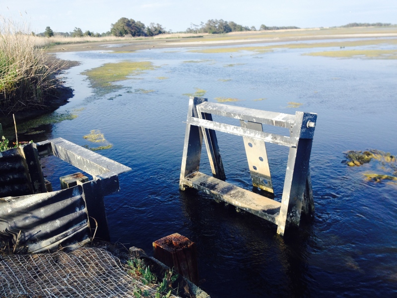
Zaribicki is with Delaware’s Mosquito Control section in the Department of Natural Resources and Environmental Control. Since controlling mosquito populations is a major consideration in a shallow salt-marsh pond like Gordons, his department manages the gates that control water levels there. Two gates – one at the northwest corner of the pond and another at the southwest corner – serve to either drain water or allow water in from high tides flooding Lewes-Rehoboth Canal. Zaribicki isn’t only concerned with mosquitoes, however. “We also manage water levels for waterfowl, shorebirds, fish, crustaceans and shoreline vegetation. It all depends on the season,” he said.
Pond now at summer level
Zaribicki said his goal is to have the pond at what he calls 50 percent pool in the summertime. That means less water-surface area for mosquito breeding. In the rest of the year, when Gordons Pond provides a haven for migrating waterfowl, shorebirds, and the fish and shellfish they feed on, he uses the gates to keep the pond at 100 percent pool.
This all came up because a few weeks ago many people riding and walking the Gordons Pond Trail noticed the water level was far lower than they remembered. “The water level was definitely below target, but I can’t make it rain or make the tides high enough to fill the pond. We went through a period of low rainfall, low humidity and relatively low tides, which meant there was no water to charge the pond and what was in there was evaporating quickly. That’s good for low mosquito numbers, but bad for letting water in,” said Zaribicki.
Zaribicki said only so-called spring tides, pulled by the moon about twice a month to higher-than-normal levels, are high enough to reach the elevation of, and fill, Gordons Pond. “But we haven’t had the buster tides we usually do. This year also looks a lot lower because last year we had lots of rain in June so the water level in the pond never receded to much below the 65 percent pool mark. The contrast between last year and this year’s lower-than-target mark makes it even more noticeable.”
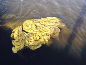
Zaribicki said lowering the pool level in the pond also allows for cross circulation of water. “When we put all the boards in the gates to keep the water level high, there’s no inflow and outflow, and that can lead to algae problems.” That’s another situation trail users have been noticing. “At the first opportunity, I’m going to try to get the algae out, but that will require enough tidal action to get water moving in the pond,” he said.
One of the rationales often cited for improving trails in natural areas like Gordons Pond is to make the public more aware of nature and more sensitive stewards. Those observing the dynamics of Gordons Pond are already proving that rationale.
On a final note, I mentioned at the beginning of this column that the broad expanse of shallow water discussed here is now known as Gordons Pond. Rehoboth history, however, tells us that the original Gordons Pond, deep enough for boaters to use for fishing and sailing, was located approximately where the Henlopen Acres Marina is now situated. Fed By Rehoboth Creek, the pond apparently was a casualty of the construction, in the early 1900s, of Lewes-Rehoboth Canal to connect Lewes Creek to the north and Rehoboth Creek to the south as a commercially navigable connection between Delaware Bay and Rehoboth Bay.
Although the original pond went away, the name – like waterfowl in the spring – survived by migrating to the north. Or, maybe, it’s all that salt that led to the name’s preservation.


