Broadkill bridge construction connected to deep history

Things have been busy lately around the Route 1 bridge over the Broadkill River. An $18 million project is underway that will see cranes, now looming over the river, dropping in 30 new, prefabricated sections of concrete deck and steel beams.
The old deck and beams of the historic crossing have deteriorated to the point of needing replacement. Concrete is cracking, steel is rusting, part of the nation’s aging infrastructure so much in the news.
What is busy now will move into super-busy mode in the next few weeks. RE Pierson’s crews will tackle the project one span at a time. There are two – one accommodating northbound traffic, the other southbound. The project design will require closure of the spans while work is being completed. The southbound span will be closed first. The dual-lane approaches to the bridges will be narrowed to single lanes so northbound and southbound traffic can be diverted onto the span not being worked on.
Delaware Department of Transportation expects the single-lane crossings to last from October into next March. As scheduled, the southbound bridge will be closed October into December, with the northbound bridge closed from December into February, after the southbound span reopens.
Reducing the number of travel lanes in that area from four to two will undoubtedly slow traffic in both directions.
Historic crossing
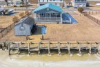
Bridges over the Broadkill at this location date back to the 1800s and possibly as early as the late 1700s. To the north and east, the broad, salt meadows of the Great Marsh spread out toward Delaware Bay. The Broadkill meanders through the marshes before emptying into the bay at Roosevelt Inlet in Lewes.
To the south and west of this crossing, however, and fed by the streams and creeks rising out of central Sussex, the waters of the Broadkill become more fresh than salt. The land begins to rise, and the river’s shores begin supporting the hardwood forests that once supplied the shipbuilding industry of Milton.
It’s at this narrowing point, where the ground hardened and proved more supportive for a crossing than the soft marshes, that a wide variety of bridges has been constructed over the course of three different centuries.
That crossing also aligns with an ancient north-south byway, known as the Whorekill Path, between coastal Native American communities around Lewes and the territories of a variety of tribes northward on the Delmarva Peninsula and above.
As mentioned in a scholarly study on the development of roads in Delaware: “Old roads followed the terrain carefully, responding to topography, water, and vegetation in seeking the path of least resistance (and expense for bridges).”
Closer to Lewes, the New Road bridge over Canary Creek also follows that Whorekill Path alignment and, similarly, is situated at a point where the marshes gave way to higher ground and a narrowing of the creek more accommodating for a bridge. That bridge and the Broadkill bridge both provide the most natural access from the northerly coastal communities to inland Sussex communities.
It’s no accident that an early Dutch trading post, dating back to about 1624, is believed to have been located just north and east of the Canary Creek bridge. Remnants of an old Dutch dike that functioned as a causeway leading to a footpath-crossing of Canary Creek are still visible just beyond and a little farther downstream from the remains of the Queen Anne Railroad crossing also at that location.
Then as now, bridges are busy places and critical to efficient transportation, especially in a region so pervasively defined by waterways large and small.

-

Dennis Forney has been a journalist on the Delmarva Peninsula since 1972 and has been writing his Barefootin’ column for The Whale and then the Cape Gazette for more than 30 years. He blogs at www.capegazette.com/blogs/dennisforney. Contact Dennis at dennisforney@capegazette.com.