DNREC encourages smartphone photos at beaches and marshes
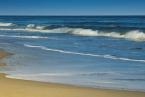
As the summer comes to a close, the Delaware Department of Natural Resources and Environmental Control is encouraging community members and visitors to the First State to use their smartphones to help monitor environmental change. DNREC’s Division of Watershed Stewardship Shoreline and Division of Climate, Coastal and Energy recently installed five monitoring stations at three sites along Delaware’s beaches and two sites comprising the Delaware National Estuarine Research Reserve.
Visitors to the beach sites can use a smartphone app called CoastSnap, while guests at the DNERR marsh and reforestation sites can upload and send photos by email through Chronolog.
CoastSnap locations include Broadkill Beach, Herring Point in Cape Henlopen State Park and the south side of Indian River Inlet in Delaware Seashore State Park. CoastSnap DE is a partnership among DNREC, the University of Delaware and Delaware Sea Grant, which funded the initiative.
Chronolog stations are located at the St. Jones Reserve in Dover and Blackbird Creek Reserve in Townsend. For both efforts, the photos will be used to create a time-lapse project for helping to observe and document environmental changes.
Instructions on how to upload photos are displayed at each of the locations.