Lewes’ Cedar Street focus of flood study

When Lewes is hit by a nor’easter or hurricane, flooding does not come from the Delaware Bay. Instead, water is pushed through Roosevelt Inlet, into the Lewes-Rehoboth Canal and onto Lewes Beach from the back side.
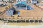
Flooding on the west end of Lewes Beach is particularly bad, and Lewes officials are beginning to look at ways to fix it.
“The purpose of the study is to identify alternatives that cost-effectively limit that flooding,” said city engineer Charlie O’Donnell of George, Miles and Buhr. “We’re not going to say we’re going to eliminate every occurrence of flooding, but we can develop alternatives that can limit it and prevent it from happening as often as it does now.”
Funding for the study is covered by a grant the city received from the Delaware Emergency Management Agency.
A team of experts has already been studying the flooding issues and presented preliminary findings during a virtual workshop Nov. 17. They used data from past storms and photographs from citizens to compile data.
They found most of the flooding occurs at a gap in a berm that was built by the U.S. Army Corps of Engineers many years ago. Over time, a corrugated metal pipe through the berm deteriorated and brought down the surrounding berm.
One of the initial ideas to fix the flooding problem is to repair the berm and install a self-regulating tide gate that would automatically shut when water levels get to a certain height. The berm would then serve as a levee to block water from inundating the wetlands and eventually the homes on the other side.
Similar approaches have been used in Dewey Beach and Kitts Hummock, O’Donnell said.
A key component to any solution will have to take into account sea-level rise, he said.
“The sea-level rise projection will depend on the life expectancy of the alternative we’re discussing at the moment,” O’Donnell said. “Some may require projects out 40 years, maybe longer. Other alternatives might only have a 25-year life expectancy.”
Lewes uses the intermediate projection from the University of Delaware’s sea-level rise projections that were published in 2017. That graph estimates sea levels will rise 1.31 feet by 2050, 2.43 feet by 2080 and 3.25 feet by 2100.
As experts continue the study, they will monitor existing data and conditions. As they develop solutions, they will estimate the cost of upgrades and projects. They will also identify potential grant sources for implementation of proposed projects.

Nick Roth is the news editor. He has been with the Cape Gazette since 2012, previously covering town beats in Milton and Lewes. In addition to serving on the editorial board and handling page layout, Nick is responsible for the weekly Delaware History in Photographs feature and enjoys writing stories about the Cape Region’s history. Prior to the Cape Gazette, Nick worked for the Delmarva Media Group, including the Delaware Wave, Delaware Coast Press and Salisbury Daily Times. He also contributed to The News Journal. Originally from Boyertown, Pa., Nick attended Shippensburg University in central Pennsylvania, graduating in 2007 with a bachelor’s degree in journalism. He’s won several MDDC awards during his career for both writing and photography. In his free time, he enjoys golfing, going to the beach with his family and cheering for Philadelphia sports teams.