Property owners seek change to Sussex land-use map
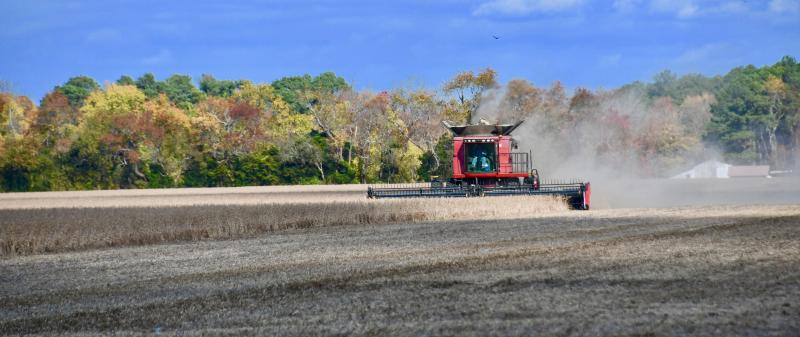
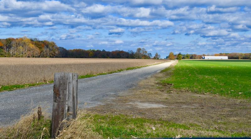
Owners of parcels totaling 247 acres on the east side of Route 1 at the Cave Neck Road intersection near Milton are seeking an amendment to Sussex County's 2018 comprehensive plan future land-use map.
The owners, Frederick and James Chappell and Thomas Robinson, want the property's designation changed from rural-low density to coastal area, which is considered a growth area.
A public hearing on the request is scheduled during the Thursday, Nov. 18 Sussex County Planning and Zoning Commission meeting, which starts at 5 p.m. in the county administration building, 2 The Circle, Georgetown.
The property is the site of two phases of the Overbrook Meadows residential development. Phase 1 for 135 lots on 64 acres was approved in 2018 and Phase 2 for 82 lots on 43.5 acres was approved in 2019. As part of the approvals, the developer will be required to provide funding for several road improvements, including a grade-separated interchange at the Route 1-Cave Neck Road intersection.
The property owners contend that designation was changed from growth area to low density after public hearings were conducted and the public record was closed. The owners discovered the change recently when Chappell was in the process of selling his property.
In a letter to council, the owners stated they did not attend meetings after the public process was concluded because they were content with the designation recommended by the planning and zoning commission and county council.
They claim on Oct. 30, 2018, county council discussed changes to the land-use map without notice to property owners. Then on Nov. 27, 2018, council voted to remove the parcels from growth-area designation.
“It is difficult to imagine why a property owner would continue to monitor this process when during the entire public process, the designation of its property reflected the property owners' view of their property. County council's unilateral decision changing the properties’ designation in its final submission to the governor did not provide us with proper notice of the change in designation nor give us an opportunity to properly present our opposition to such change,” the owners wrote.
SARG urges public involvement
The group Sussex Alliance for Responsible Growth issued an email last week alerting residents about the proposed amendment.
According to SARG, amending the comp plan to designate these parcels as coastal area would open up a large number of options for the zoning of this property. With the current low-density designation, a maximum of up to 2 residential units per acre is allowed. In the coastal area, the density could go as high as 12 units per acre and could allow for up to 2,976 residential dwellings or a combination of residential with other permitted uses including but not limited to heavy commercial and manufacturing.
They also noted that state planners do not support the proposed amendment. Comments from state agencies following a Preliminary Land Use Service review of the proposal outline several reasons why the change should not be granted.
State agencies against change
Department of Natural Resources and Environmental Control reviewers are not in support of this change due to the parcels being designated as out of play and Level 4 by the Delaware Strategies for State Policies and Spending. In addition, these parcels contain environmental features that are inconsistent with more intensive development, as noted below.
Groundwater recharge areas are located on some of the parcels. These areas have soils that are conducive to water infiltrating downward from surface water into groundwater. Preservation of these areas is important for replenishing groundwater supplies and ensuring drinking water for future generations.
Freshwater and marine wetlands are present on the northern half of a section of the property and lie within the Great Marsh Natural Area and the Delaware Ecological Network. Natural areas contain lands of statewide significance identified by the Natural Areas Advisory Council as the highest quality and most important natural lands remaining in Delaware. The Delaware Ecological Network consists of lands having significant ecological value. Forest disturbances in these areas will jeopardize the parcel and possibly areas beyond the parcel's boundary.
The PLUS report noted there is an active bald eagle nest within one of the parcels. Bald eagles and their nests are protected under the federal Bald and Golden Eagle Protection Act. Additionally, the nest itself is protected by state law. DNREC officials said four other birds listed by the state as rare, threatened or endangered species, including the broad-winged hawk, northern harrier, great black-backed gull and black-necked stilt are or may be present.
In addition, the report stated the parcels are not close to public services such as water, sewer, police, fire and schools.
“It is the opinion of the Office of State Planning that this change would constitute a major change to the currently certified comprehensive plan and this office, for the reasons stated in their letter, objects to the comprehensive plan amendment,” the report concluded.
See the application at: tinyurl.com/3uzxt9za.
See the meeting agenda at: tinyurl.com/kmc6vkrh.


