Protecting the highway from Mother Nature
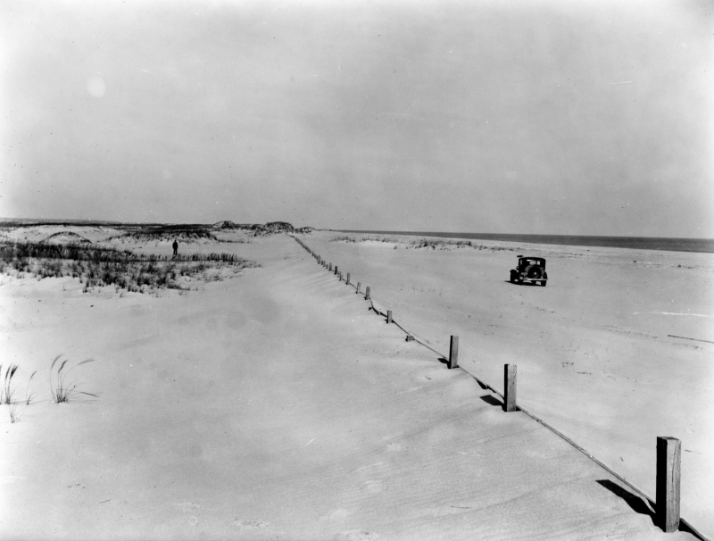
“Ocean Highway damaged by storm.” Sound familiar? Delaware officials have been battling with Mother Nature ever since a road was created on the narrow strip of land between Dewey Beach and Bethany Beach.
The story that accompanied the aforementioned headline in a January 1934 edition of the Evening Journal discussed the damage caused by a storm in August 1933.
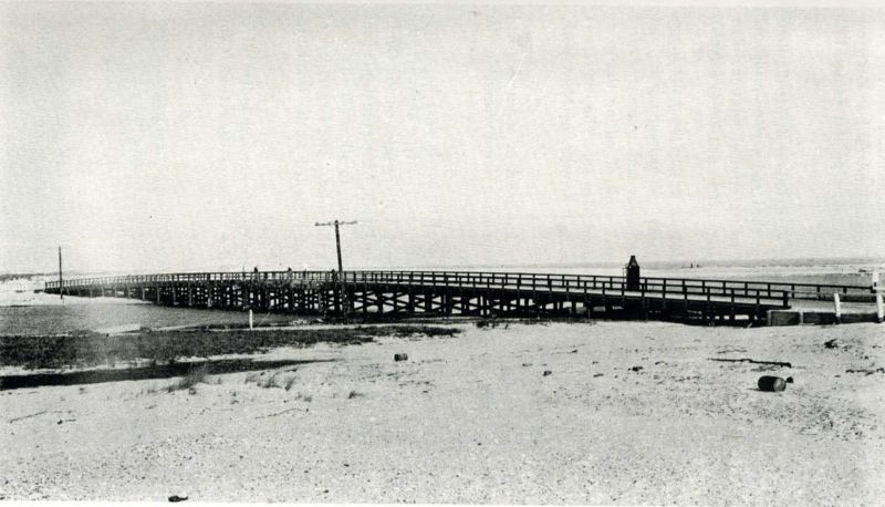
“The ocean highway [today’s Route 1] constructed of local gravel from between Bethany Beach and Rehoboth was opened for traffic just previous to the storm. While the section of the ocean highway from Bethany Beach to the Indian River Inlet was but little damaged, the newly completed section between Dewey Beach and the inlet was badly washed in many places, particularly between the old inlet south of the Coast Guard station and the present inlet bridge. This section received the full force of the waves and was practically washed away with the exception of the bridges and bulkheads which were not damaged.”
The highway was built in 1933. Highway Engineering and Construction Company had the lowest bid of $65,397 for the section from Rehoboth to the inlet.
The six-mile section between Dewey Beach and the inlet was resurfaced in 1940. The low bid was $38,482.
“The section between Dewey Beach and the Indian River Inlet was damaged during the winter months due to heavy traffic moving over the roadway in connection with the construction of the Charles W. Cullen Bridge and the new jetties at the inlet,” a May 1940 Evening Journal article reads. “Summer vacation traffic is expected to be heavy on the highway after the approaches to the Cullen Bridge have been completed and the bridge is opened.”
The bridge officially opened to traffic later that month.
The idea of a road connecting Rehoboth Beach to Bethany Beach surfaced in the 1920s. A survey was undertaken by Webster Warren of Ellendale.
“While many believe that the building of this boulevard is impractical because of the shifting sands and high tides, it is the opinion of engineers that the road could be substantially constructed on the marsh land about 50 yards back of the high tide mark,” a September 1926 article in the Evening Journal reads. “It is said there is plenty of available material for the foundation of the road. A new road would develop this water front by making easy access to these lots, which if sold would mean a continuous resort from Lewes to Rehoboth and then south below the Indian River Inlet.”
Nick Roth is the news editor. He has been with the Cape Gazette since 2012, previously covering town beats in Milton and Lewes. In addition to serving on the editorial board and handling page layout, Nick is responsible for the weekly Delaware History in Photographs feature and enjoys writing stories about the Cape Region’s history. Prior to the Cape Gazette, Nick worked for the Delmarva Media Group, including the Delaware Wave, Delaware Coast Press and Salisbury Daily Times. He also contributed to The News Journal. Originally from Boyertown, Pa., Nick attended Shippensburg University in central Pennsylvania, graduating in 2007 with a bachelor’s degree in journalism. He’s won several MDDC awards during his career for both writing and photography. In his free time, he enjoys golfing, going to the beach with his family and cheering for Philadelphia sports teams.


