Wetlands a hot topic during Coral Lakes hearing

Robinsonville Road near Lewes is rapidly becoming a sought-after address.
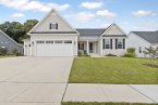
At its Jan. 27 meeting, Sussex County Planning and Zoning Commission heard plans for Coral Lakes, a 315-lot cluster subdivision on 152 acres. The application is included on the commission’s Thursday, Feb. 10 agenda.
The proposed subdivision would be constructed across the road from Chase Oaks, which is under construction with 253 lots on 145 acres on both sides of Webbs Landing Road, and south of Tanager Woods, with 168 lots on 103 acres, which has been approved. Another new subdivision, Tidewater Landing, with 213 lots on 163 acres, is in its final phases of construction.
Debating wetlands
During the Jan. 27 public hearing, wetlands and forests dominated the discussion and testimony by nearby residents, many from the Chapel Green community, which shares a border with the proposed subdivision.
Commissioners received an education on the Navigable Waters Protection Rule and the Waters of the United States federal initiatives to clarify water resource management, and define wetlands that are jurisdictional and subject to regulations.
So how do these federal initiatives relate to a land-use proposal in Sussex County?
A court-ordered change in 2020 to regulations defining jurisdictional wetlands at the federal level pertains directly to the proposed Coral Lakes property.
Under the previous federal regulations, about 30 acres of wetlands were delineated as jurisdictional wetlands not to be disturbed. Under the new regulations, the number has been reduced to around 5 acres. Under the current plan, about 25 acres of that area will be filled in for development.
The Environmental Protection Agency and the U.S. Army Corps of Engineers are working to get the 2015-enacted definition of waters in the United States reinstated.
John Horner, general counsel for applicant Schell, said a wetlands delineation was conducted to determine which wetlands were jurisdictional. He said jurisdictional wetlands are located at the rear of the property and will be protected by a buffer following regulations in the proposed update of the county wetlands buffer ordinance.
Horner said low, wet areas on the property are isolated and not regulated. He said water management of those areas can be replicated in the proposed stormwater management plan for the parcel.
“We have stayed away from the most environmentally sensitive areas and are building in the more suitable areas,” he said.
Horner said new federal regulations allow for construction on lots in areas that were previously designated as wetlands, such as isolated wetlands, which are not regulated.
Jill Hicks, a resident of Chapel Green, said there could be as much as 56 acres of wetlands on the property. “The U.S. Army Corps has not been to the site,” she said. “All these areas could be deemed jurisdictional with new regulations from the new administration.”
Ann Conlin, a Chapel Green resident, said she's concerned the wetlands report could be outdated, and she also questioned how jurisdictional wetlands were determined. She said regulations are being revised, which could affect this site.
“Wouldn't it be better to see how changes impact jurisdictional wetlands?” she asked.
Commission Chair Bob Wheatley said the commission can only make a decision based on the rules in place currently, not possible changes in the future.
“We are mindful of that, but it does appear to me that the applicant is following the rules in place now,” Wheatley said. “We have to follow the law relating to wetlands, and the last word is from the Army Corps of Engineers,” he said. “That's the word we have on this property. The wetlands have been decided.”
PLUS comments on wetlands
During the Office of State Planning Preliminary Land Use Service review of the subdivision, Department of Natural Resources and Environmental officials noted that a 2019 plan for the same parcel included 30 acres of wetlands that were to be left untouched.
DNREC officials recommended that the developer revert to the previous plan. “Do not disturb wetland areas, even if they are no longer considered to be jurisdictional wetlands under current federal requirements. The newest project application proposes to disturb/fill upwards of 25 acres of non-tidal wetlands. Only 5 acres of now jurisdictional wetlands (under the new ruling) will remain, with no wetland permitting or wetland mitigation required. Filling these wetland areas, then building homes and infrastructure upon them, will directly result in adverse drainage and flooding impacts for future residents,” the report noted.
About Coral Lakes
MacKenzie Peet, attorney for the applicant, said the parcel is located in the county's coastal area, which is a growth area where cluster development is encouraged, according to the county's comprehensive plan.
She said the project would incorporate superior-design elements for cluster subdivisions as outlined in county code, including 75 acres of open space, with 46 acres interconnected. Other features include a 30-foot forested perimeter buffer, no lots in wetlands, lots at least 50 feet from the property boundary, a 50-foot buffer from nontidal wetlands, and central water and sewer service. Planned amenities include sidewalks on one side of all streets, a pool, pool house, pocket parks, a dog park and trails. There would also be a connection to a DelDOT shared-use path along Robinsonville Road.
The attorney said the developer will install drains along the rear areas of all lots bordering Chapel Green properties to provide better water management.
Peet said trees would be cleared only where necessary for development of the community, and all trees within buffers would remain.
The applicant is proposing to purchase 11 lots at $20,000 each under the county's bonus-density program. The funds are used for land preservation in the county.
Peet said although the state lists sections of the property in both Level 3 and Level 4 of the Delaware Strategies for State Policies and Spending, the levels are not a land-use plan. She said the county has a long history of approving major subdivisions in those levels, including 43 subdivision approvals in Level 4 areas in proximity to the site.
The state maintains that Level 4 areas are rural in nature with agricultural-related activities and preserved land.
Horner said a determination was also made concerning the flora and fauna on the property. “It's not a requirement, but we want to be good stewards of the land,” he said.
He said no rare, threatened or endangered species were found on the property. He said if any were found, the property would have not been developed.
County Planning & Zoning Director Jamie Whitehouse said his office had received 79 letters and a petition signed by 221 residents in opposition to the application.
Concerns over tree cutting
The plans include removal of 110 acres of forest, which was met with protest by nearby residents who claim clear-cutting will impact water drainage and destroy wildlife habitat.
Resident Jill Hicks said the water table in many areas around the parcel is less than 1 foot, and many of the soils are very limited in suitability for development.
She said there's no doubt the water table will rise with the loss of 110 acres of trees, which soak up water and help prevent flooding. “We request that you do not allow clear-cutting of this forest,” she said to the commission.
Sergei Boboshko, a Chapel Green resident, said more and more residents are speaking out against what he called uncontrolled development. “The destruction of forests and the explosion on our roads is affecting our lifestyle,” he said.
He presented the commission with a history of proposed development of the property dating back to 2009. He said the original application included 209 lots with 35 acres of forest being removed.
During the PLUS review, DNREC officials recommended that the applicant complete a forest assessment to determine mature tree growth. In addition, it was noted that the property is located within the Delaware Ecological Network. “Removing forested areas within the Delaware Ecological Network should be avoided to the greatest extent possible. These areas provide wildlife habitat, uptake nutrients, infiltrate stormwater, and improve water quality,” the report noted.
Milton resident Jeff Seemans said clear-cutting in the county will not stop until the council adopts a forest preservation ordinance.
He also questioned whether or not the design of the community complies with superior-design requirements under county code. “Is this preliminary plan superior when there are 13 retention ponds being proposed on poor drainage areas with high water tables?” he asked.
Seemans said the design elements should be sent back for a complete do-over.
Robinsonville Road traffic
William Hicks of Chapel Green said four subdivisions are either under construction or planned within a quarter-mile along Robinsonville Road. “The road is not capable of the traffic load,” he said, adding that Delaware Department of Transportation analysis shows that within eight years, 10 intersections in the area will have failing levels of service in the afternoons and on Saturdays. He said three of those intersections will be designated as failing all the time.
“And the state will provide little or no funds for infrastructure because it's in a Level 4 area,” he said.
When asked by Commissioner Holly Wingate, DelDOT's Bill Brockenbrough said there are no DelDOT road projects planned along Robinsonville Road. However, developers are required to fund road improvement projects based on the impact of their developments.
The proposed subdivision is within the county's Henlopen Transportation Improvement District, and the developer will be required to pay a per-unit fee for road improvements. DelDOT also required the developer to submit a traffic-impact study. According to the study, at build-out, the development would generate an average daily traffic count of 2,988 vehicles. The developer would also be required to make road improvements along the frontage of the property.
Hicks said residents are also concerned about the stormwater outfall for the proposed project, Sarah Run, which flows through the community. He said residents are concerned that more runoff will exacerbate flooding issues that already occur during rainy periods.
Wheatley said the law prohibits the release of stormwater from a new development onto neighboring properties. “They can't make your situation any worse,” he said.
More info
More information on the Coral Lakes subdivision is available at:
To listen to a video file of the hearing, go to tinyurl.com/2s4b7jfy.
See the federal waterways rules at: epa.gov/wotus/current-implementation-waters-united-states.