Sussex P&Z wants more info on Stillwater Harbor
Editor’s note: This is the second of two stories about Stillwater Harbor. The first part was published in the May 5 edition.
At its May 11 meeting, the Sussex County Planning & Zoning Commission officially closed the public record on the proposed Stillwater Harbor cluster subdivision.
However, the commission's motion left the record open only for the receipt of additional information including a report from county engineering on the plan's resource buffer and an analysis of an easement required for an emergency access road.
The commission must act on the application within 45 days once the information is received.
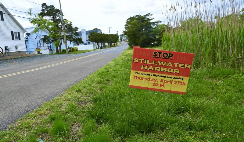
The proposed subdivision has stirred concern among residents living in the Oak Orchard area, and particularly those who live along River Road. In the public record is a petition signed by more than 1,600 people in opposition to the application.
About the subdivision
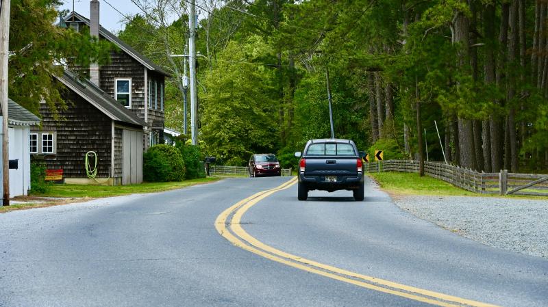
The subdivision plan includes 123 single-family home lots on a 57-acre parcel on the north side of River Road near the Chiefs Road intersection. The property is in close proximity to Indian River Bay, separated by River Road and a line of houses with water access.
The parcel is zoned GR, general residential, and MR, medium-density residential. The majority of the parcel is woodlands.
The plan includes a 100-foot buffer along two acres of tidal wetlands and a 30-foot buffer along three acres of nontidal wetlands along the western edge of the property. There would also be a 30-foot buffer along farmland adjacent to the property and a 20-foot buffer along residential areas.
All lots would be clustered toward the center of the property to preserve the wetland areas.
The property contains 54 acres of woods. In the plan, 42 acres of woods would be removed during construction, with 12 acres of woods being preserved. Ten acres of existing forest would be preserved, with nearly two acres of restored woodlands.
The plan includes 26 acres of interconnected open space, or 47% of the parcel's total acreage.
Amenities would include a pool, bathhouse, sidewalks on both sides of interior streets and a wood-chip trail to a wooded area on the western edge of the parcel.
The development team said while flooding would still occur on River Road, Stillwater Harbor's proposed stormwater management would lessen the impact in the immediate area with four stormwater retention ponds, which would help regulate water runoff to the Chiefs Road area.
Questions about access
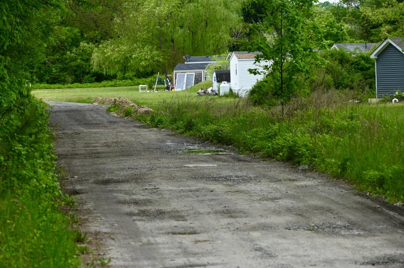
The plan includes an emergency access road for ambulances and fire apparatus from the rear of the property along a 50-foot easement to Draine Lane. The gated access would only be used in the event of flooding on River Road. The unimproved road is used by several residents.
Attorney Mackenzie Peet, representing developer Stillwater Harbor LLC, said members of the Indian River Volunteer Fire Company had expressed concerns about getting to the subdivision during times of flooding on River Road. She said they approved of the proposed access road.
The road would be gated on the Stillwater Harbor side with a KnoxBox with keys to Indian River Volunteer Fire Company and the homeowners association.
Darrell Jackson, speaking on behalf of residents living along Draine Lane, said the unimproved road is not suitable for emergency access. “It’s not even wide enough for two vehicles,” he said. “And it’s a low area and most of the lane is wet all the time.”
He said he and his neighbors are concerned that Stillwater Harbor residents would use the gate and trespass on their properties. “This lane has been retained for private access for many decades for farmers and residents,” he said.
Robert Draine said the developers have made two offers to purchase access, but he will never sell any of his property.
“The lane will not support any kind of traffic,” he said.
Impassioned plea
No one who testified in opposition was as sincere and heartfelt as Nanticoke Indian Tribe member Charles C. Clark IV (Little Owl). He spoke at length about the history of the area and its importance to the Nanticoke tribe and his family.
Clark, who owns Riverdale Park off River Road, with 400 modular homes not far from the proposed development, said the developers have no understanding of the history of the area.
He said he would never expand the park. “My father told me not to be greedy,” he said.
He said his grandfather and great-grandfather stepped off each of the lots. "We are working with nature instead of working against it,” he said.
He said the developers do not know the area contains remains of his relatives and other Nanticokes. “What else don’t they know?” he asked.
Clark questioned the environmental assessment made of the property. “You can't replace 63 years of living here,” he said.
He said it's not uncommon to see hawks, eagles, herds of deer and turkeys on the fields. His said his family will never develop adjacent to the proposed community, including 50 acres of woodlands that he has been approached to sell several times.
He said the property for the proposed subdivision is one of only two remaining stands of undeveloped woods in the area. “You'll see extinction of all wildlife there,” he said.
Clark said he has several reasons to not trust government when it comes to development. He said during an excavation of a road to expand Sussex County sewer, more than 400 Native American artifacts were found. “They studied them and said they would return them to the Clark family. We are still asking for those artifacts. The government stole from my land and won't return it,” he said.
Clark said he has experienced flooding along River Road his entire life. He said it doesn't take a major storm to cause flooding. “The flooding problem is getting worse as more development is allowed on the uplands,” he said. “Overgrowth is a cancer, and we need to stop this cancer from eating up Sussex County.”
Impaired waterways
Annabella Larsen, a retired Prime Hook National Wildlife Refuge biologist who lives near the property, showed a detailed presentation pertaining to the ecological and traffic impact of the proposed community.
“County planners and elected local officials are not performing effective land-use practices to protect natural resources, water quality and residents' quality-of-life basic requirements,” she said.
Over the past 30 years, land-use decisions have destroyed more than 20%, or 57,517 acres, of the state's wetlands, she said, adding the Inland Bays drainage areas have experienced the highest losses – 52% from residential development and 48% from agriculture activities. Ditching, wildlife and plant destruction, and lack of appropriate buffers are contributing factors, Larsen said.
She said, according to the Environmental Protection Agency, Delaware has the most miles of polluted waterways in the nation caused by illegal fertilizer and pesticide runoff and bacteria. The major contributing factors include housing development, urban and industrial runoff, and land clearing for development.
In EPA testing of 30 square miles of Indian River Bay and Inland Bays, Larsen said, fish and aquatic life waters failed tests 98%, shellfish waters 100% and waters of ecological significance 90%.
Larsen questioned if private property would be seized to make way for River Road improvements. “How can the approval of this clustered 123 single-family subdivision directly connected to a substandard road be justified?” she asked. “How will River Road absorbing the ingress/egress of an additional 1,258 vehicle trips per day be rationalized?”
“There is no space for the developer's proposed acceleration lanes and very restricted current road right-of-way dimensions along the extremely flood-prone River Road,” she added.


